Stewarton, Argyll
Human settlement in Scotland

Stewarton
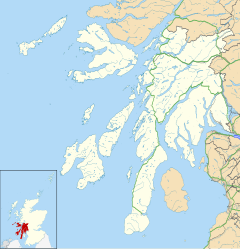
Location within Argyll and Bute
- Argyll and Bute
- Argyll and Bute
- Argyll and Bute
- Argyll and Bute
Stewarton (Scottish Gaelic: Baile nan Stiùbhartach, pronounced [ˈpalə nəɲ ˈʃtʲuː.ərˠʃt̪əx]) is a hamlet on the junction of the B842 and B843 roads, in Kintyre, Argyll and Bute, Scotland, located around 1.5 miles (2.4 km) west of Campbeltown.[1]
Plantation Halt was a nearby station on the Campbeltown and Machrihanish Light Railway that opened in 1906 and closed in 1932.
References
- ^ "Stewarton". Gazetteer for Scotland. Retrieved 29 August 2020.
Wikimedia Commons has media related to Stewarton, Argyll and Bute.
Portal:
 Scotland
- v
- t
- e


