Santa Cruz District, Ancash
District in Ancash, Peru

Coat of arms
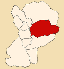
Location of Santa Cruz in the Huaylas province
 Peru
PeruThe Santa Cruz District (Spanish: Distrito de Santa Cruz) is one of 10 districts of the Huaylas Province in the Ancash Region of Peru.[1] The capital of the district is Huaripampa.[2]
Geography
The district is located in the central-eastern part of the province at an elevation of 2,900 m.
The Cordillera Blanca traverses the district. Some of the highest mountains of the district are listed below:[3]
- Allpamayu
- Aqu Punta
- Artesonraju
- Chuchu Rumi
- Kitarahu
- Pirqa Rumi
- Pukahirka
- Pukarahu
- Puma Pampa
- Qaras
- Rinrihirka
- Sintiru
- Suyt'uqucha
- Tawlli Qaqa
- Tawllirahu
- Taya Pampa
- Wamanpinta
Ethnic groups
The people in the district are mainly indigenous citizens of Quechua descent. Quechua is the language which the majority of the population (86.95%) learnt to speak in childhood, 12.63% of the residents started speaking using the Spanish language (2007 Peru Census).[4]
See also
- Allpamayu (river)
- Hatunqucha (Pirqarumi)
- Hatunqucha (Qaras)
- Ichikqucha
- Tawlliqucha
- Yuraqmayu
- Yuraqqucha
References
- ^ (in Spanish) Santa Cruz - Caraz - Huaylas - Ancash. Official website of the Santa Cruz district. Retrieved March 7, 2008
- ^ spij.minjus.gob.pe/Textos-PDF/Leyes/.../10207.pdf Law No. 10207
- ^ escale.minedu.gob.pe - UGEL map of the Huaylas Province (Ancash Region)
- ^ inei.gob.pe Archived 2013-01-27 at the Wayback Machine INEI, Peru, Censos Nacionales 2007, Frequencias: Preguntas de Población: Idioma o lengua con el que aprendió hablar (in Spanish)
External links
- (in Spanish) Official website of the Huaylas province
- (in Spanish) Official website of the Santa Cruz district
- v
- t
- e

- Caraz
- Huallanca
- Huata
- Huaylas
- Mato
- Pamparomas
- Pueblo Libre
- Santa Cruz
- Santo Toribio
- Yuracmarca
8°52′14″S 77°54′19″W / 8.87056°S 77.90528°W / -8.87056; -77.90528
 | This Ancash Region geography article is a stub. You can help Wikipedia by expanding it. |
- v
- t
- e


