Grade II* listed buildings in South Somerset

South Somerset is a local government district in the English county of Somerset. The South Somerset district occupies an area of 370 square miles (958 km2),[1] stretching from its borders with Devon and Dorset to the edge of the Somerset Levels. The district has a population of about 158,000,[2] and has Yeovil as its administrative centre.
In the United Kingdom, the term listed building refers to a building or other structure officially designated as being of special architectural, historical or cultural significance; Grade II* structures are those considered to be "particularly significant buildings of more than local interest".[3] Listing was begun by a provision in the Town and Country Planning Act 1947. Once listed, severe restrictions are imposed on the modifications allowed to a building's structure or its fittings. In England, the authority for listing under the Planning (Listed Buildings and Conservation Areas) Act 1990[4] rests with Historic England, a non-departmental public body sponsored by the Department for Digital, Culture, Media and Sport; local authorities have a responsibility to regulate and enforce the planning regulations.
There are 266 Grade II* listed buildings in South Somerset.
Map all coordinates using OpenStreetMap
Download coordinates as:
- KML
- GPX (all coordinates)
- GPX (primary coordinates)
- GPX (secondary coordinates)
Buildings
| Name | Location | Type | Completed [note 1] | Grid ref.[note 2] Geo-coordinates | Entry number [note 3] | Image | Ref. |
|---|---|---|---|---|---|---|---|
| 1–2 Castle Cottages | Chilthorne Domer | House | Early-mid 17th century | ST5241319269 50°58′15″N 2°40′45″W / 50.97086°N 2.679103°W / 50.97086; -2.679103 (1–2 Castle Cottages) | 1057244 | 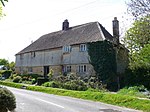 More images | [5] |
| Abbey House | South Cadbury | House | 15th century | ST6237624867 51°01′19″N 2°32′16″W / 51.021935°N 2.5378°W / 51.021935; -2.5378 (Abbey House) | 1258892 |  Upload Photo | .[6] |
| Admiral Hood Monument | Compton Dundon | Monument | Early 19th century | ST4959233808 51°06′05″N 2°43′17″W / 51.101346°N 2.721304°W / 51.101346; -2.721304 (Admiral Hood Monument) | 1056743 |  More images | [7] |
| Ansford Lodge | Ansford | House | Late 18th century | ST6415432918 51°05′40″N 2°30′48″W / 51.094442°N 2.513252°W / 51.094442; -2.513252 (Ansford Lodge) | 1307605 |  | [8] |
| Ashford House | Ilton | House | Probably 17th century | ST3567118959 50°57′59″N 2°55′03″W / 50.966443°N 2.917458°W / 50.966443; -2.917458 (Ashford House) | 1057048 | Upload Photo | [9] |
| Ashington Manor | Chilton Cantelo | House | 15th century | ST5611521473 50°59′27″N 2°37′36″W / 50.990972°N 2.62665°W / 50.990972; -2.62665 (Ashington Manor) | 1056833 | Upload Photo | [10] |
| Ashlar House | Martock | House | Early 18th century | ST4610419113 50°58′08″N 2°46′08″W / 50.9689°N 2.768924°W / 50.9689; -2.768924 (Ashlar House) | 1265440 | Upload Photo | [11] |
| Avishays | Chaffcombe | House | 17th century | ST3521609255 50°52′45″N 2°55′20″W / 50.879141°N 2.92221°W / 50.879141; -2.92221 (Avishays) | 1366399 |  More images | [12] |
| Balsam House | Wincanton | House | 17th century | ST7168228520 51°03′19″N 2°24′19″W / 51.055318°N 2.405411°W / 51.055318; -2.405411 (Balsam House) | 1238556 |  | [13] |
| Baptist Church | Chard | Schoolroom | Later 19th century | ST3218408499 50°52′19″N 2°57′55″W / 50.871995°N 2.96516°W / 50.871995; -2.96516 (Baptist Church) | 1206076 |  More images | [14] |
| Bromes House | Isle Abbotts | Farmhouse | 1627 | ST3515620792 50°58′58″N 2°55′30″W / 50.982866°N 2.925119°W / 50.982866; -2.925119 (Bromes House) | 1249589 | Upload Photo | [15] |
| Burton Pynsent House | Curry Rivel | House | Pre- c. 1756 | ST3725724598 51°01′02″N 2°53′45″W / 51.017319°N 2.895851°W / 51.017319; -2.895851 (Burton Pynsent House) | 1373913 | Upload Photo | [16] |
| Candle Cottage and garden walls and railing to East | Crewkerne | House | Late 15th century | ST4423009817 50°53′06″N 2°47′39″W / 50.885136°N 2.794185°W / 50.885136; -2.794185 (Candle Cottage and garden walls and railing to East) | 1202997 | Upload Photo | [17] |
| Cathanger | Fivehead | House | 1988 | ST3423922881 51°00′06″N 2°56′19″W / 51.001544°N 2.938559°W / 51.001544; -2.938559 (Cathanger) | 1263673 | Upload Photo | [18] |
| Chapel Cross | South Cadbury | House | 13th century | ST6308226316 51°02′06″N 2°31′40″W / 51.03501°N 2.527883°W / 51.03501; -2.527883 (Chapel Cross) | 1258890 |  More images | [19] |
| Chard Manor Farmhouse | Chard | Farmhouse | 15th or early 16th century | ST3226208164 50°52′08″N 2°57′50″W / 50.868992°N 2.963989°W / 50.868992; -2.963989 (Chard Manor Farmhouse) | 1197429 | Upload Photo | [20] |
| Chard School | Chard | House | 1583 | ST3245208656 50°52′24″N 2°57′41″W / 50.873438°N 2.961381°W / 50.873438; -2.961381 (Chard School) | 1205594 |  More images | [21] |
| Charlton House | Charlton Mackrell | House | Extended | ST5295029075 51°03′33″N 2°40′22″W / 51.059076°N 2.672731°W / 51.059076; -2.672731 (Charlton House) | 1056766 | 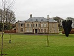 More images | [22] |
| Church Cross in Churchyard of St James' Church | Preston Plucknett | Cross | Possibly 15th century | ST5347916220 50°56′37″N 2°39′49″W / 50.943531°N 2.663532°W / 50.943531; -2.663532 (Church Cross in Churchyard of St James' Church) | 1173415 | Upload Photo | [23] |
| Church House with integral orangery | Yeovil | House | c. 1770 | ST5561516020 50°56′31″N 2°37′59″W / 50.941902°N 2.633107°W / 50.941902; -2.633107 (Church House with integral orangery) | 1055715 | Upload Photo | [24] |
| Church of All Saints | Castle Cary | Church | 19th century | ST6391632055 51°05′12″N 2°31′00″W / 51.086667°N 2.516564°W / 51.086667; -2.516564 (Church of All Saints) | 1056241 |  More images | [25] |
| Church of All Saints | Closworth | Church | 13th century | ST5639310059 50°53′18″N 2°37′17″W / 50.888361°N 2.62132°W / 50.888361; -2.62132 (Church of All Saints) | 1057233 | 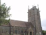 More images | [26] |
| Church of All Saints | Kingsdon | Church | 15th century | ST5157026203 51°01′59″N 2°41′31″W / 51.033137°N 2.692036°W / 51.033137; -2.692036 (Church of All Saints) | 1223613 |  More images | [27] |
| Church of All Saints | Kingweston | Church | 1852-1855 | ST5251731324 51°04′45″N 2°40′45″W / 51.079262°N 2.679205°W / 51.079262; -2.679205 (Church of All Saints) | 1307683 |  More images | [28] |
| Church of All Saints | Lopen | Church | 12th century | ST4271414498 50°55′37″N 2°48′59″W / 50.927077°N 2.81647°W / 50.927077; -2.81647 (Church of All Saints) | 1056994 |  More images | [29] |
| Church of All Saints | Merriott | Church | 13th century | ST4427212844 50°54′44″N 2°47′39″W / 50.912358°N 2.794051°W / 50.912358; -2.794051 (Church of All Saints) | 1175447 |  More images | [30] |
| Church of St Andrew | Aller | Church | 11th century | ST3963228805 51°03′19″N 2°51′46″W / 51.0554°N 2.862699°W / 51.0554; -2.862699 (Church of St Andrew) | 1227327 |  More images | [31] |
| Church of St Andrew | Ansford | Church | 15th century | ST6382332909 51°05′40″N 2°31′05″W / 51.09434°N 2.517977°W / 51.09434; -2.517977 (Church of St Andrew) | 1307553 |  More images | [32] |
| Church of St Andrew | Thorne Coffin | Church | 1613 | ST5260417604 50°57′21″N 2°40′34″W / 50.955905°N 2.676166°W / 50.955905; -2.676166 (Church of St Andrew) | 1263070 | 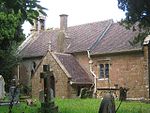 More images | [33] |
| Church of St Andrew | Compton Dundon | Church | Early 14th century | ST4794232532 51°05′23″N 2°44′41″W / 51.089726°N 2.744683°W / 51.089726; -2.744683 (Church of St Andrew) | 1176782 |  More images | [34] |
| Church of St Andrew | Dowlish Wake | Church | 14th century | ST3756612944 50°54′37″N 2°53′19″W / 50.910363°N 2.888647°W / 50.910363; -2.888647 (Church of St Andrew) | 1366405 |  More images | [35] |
| Church of St Andrew | Northover, Ilchester | Church | 14th century | ST5234823141 51°00′20″N 2°40′50″W / 51.00567°N 2.680538°W / 51.00567; -2.680538 (Church of St Andrew) | 1267315 | 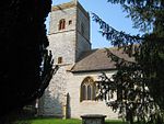 More images | [36] |
| Church of St Andrew | Puckington | Church | 13th century | ST3770118288 50°57′38″N 2°53′18″W / 50.960633°N 2.888438°W / 50.960633; -2.888438 (Church of St Andrew) | 1057727 | 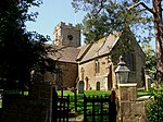 More images | [37] |
| Church of St Bartholomew | Yeovilton | Church | c. 1300 | ST5468023013 51°00′17″N 2°38′50″W / 51.004708°N 2.647287°W / 51.004708; -2.647287 (Church of St Bartholomew) | 1056787 |  More images | [38] |
| Church of St Catherine | Montacute | Church | 19th century | ST4967316952 50°56′59″N 2°43′04″W / 50.949793°N 2.717802°W / 50.949793; -2.717802 (Church of St Catherine) | 1253547 |  More images | [39] |
| Church of St David | Barton St David | Church | 12th century | ST5397231699 51°04′58″N 2°39′31″W / 51.082752°N 2.658484°W / 51.082752; -2.658484 (Church of St David) | 1176035 | 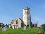 More images | [40] |
| Church of St James | East Lambrook, Kingsbury Episcopi | Church | 19th century | ST4317218665 50°57′53″N 2°48′38″W / 50.96459°N 2.810605°W / 50.96459; -2.810605 (Church of St James) | 1056883 | 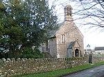 More images | [41] |
| Church of St James | Chilton Cantelo | Church | 15th century | ST5702522179 50°59′51″N 2°36′50″W / 50.997389°N 2.613769°W / 50.997389; -2.613769 (Church of St James) | 1056835 |  More images | [42] |
| Church of St James | Preston Plucknett | Church | 1420 | ST5347516235 50°56′37″N 2°39′49″W / 50.943666°N 2.663591°W / 50.943666; -2.663591 (Church of St James) | 1346135 |  More images | [43] |
| Church of St John the Baptist | South Brewham | Church | 13th century | ST7196436143 51°07′26″N 2°24′07″W / 51.123877°N 2.401981°W / 51.123877; -2.401981 (Church of St John the Baptist) | 1056463 |  More images | [44] |
| Church of St John the Baptist | Pitney | Church | 13th century | ST4446328502 51°03′11″N 2°47′37″W / 51.053164°N 2.793732°W / 51.053164; -2.793732 (Church of St John the Baptist) | 1056546 | 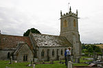 More images | [45] |
| Church of St John the Baptist | Horsington | Church | 15th century | ST7029723861 51°00′48″N 2°25′29″W / 51.013355°N 2.424788°W / 51.013355; -2.424788 (Church of St John the Baptist) | 1238063 | 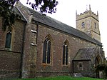 More images | [46] |
| Church of St John the Baptist | North Cheriton | Church | 14th-century | ST6872625826 51°01′51″N 2°26′50″W / 51.03094°N 2.447351°W / 51.03094; -2.447351 (Church of St John the Baptist) | 1274277 |  More images | [47] |
| Church of St John the Evangelist and All Saints | Kingstone | Church | Post 1540 | ST3788213637 50°55′08″N 2°53′06″W / 50.918834°N 2.885067°W / 50.918834; -2.885067 (Church of St John the Evangelist and All Saints) | 1057025 |  More images | [48] |
| Church of St Lawrence | Cucklington | Church | 13th century | ST7552227775 51°02′56″N 2°21′02″W / 51.048797°N 2.350573°W / 51.048797; -2.350573 (Church of St Lawrence) | 1274765 |  More images | [49] |
| Church of St Margaret | Middle Chinnock | Church | 12th century | ST4721213129 50°54′55″N 2°45′08″W / 50.915197°N 2.752277°W / 50.915197; -2.752277 (Church of St Margaret) | 1057169 |  More images | [50] |
| Church of St Martin of Tours | West Coker | Church | 13th or 14th century | ST5164913573 50°55′10″N 2°41′21″W / 50.91958°N 2.689225°W / 50.91958; -2.689225 (Church of St Martin of Tours) | 1345829 |  More images | [51] |
| Church of St Mary | Buckland St Mary | Church | 1853-1863 | ST2708313408 50°54′56″N 3°02′19″W / 50.91551°N 3.038623°W / 50.91551; -3.038623 (Church of St Mary) | 1277983 |  More images | [52] |
| Church of St Mary | Abbas and Templecombe | Church | 12th century | ST7085922669 51°00′10″N 2°25′00″W / 51.002665°N 2.41668°W / 51.002665; -2.41668 (Church of St Mary) | 1366329 |  More images | [53] |
| Church of St Mary | Charlton Mackrell | Church | 13th century | ST5282728336 51°03′09″N 2°40′28″W / 51.052421°N 2.674389°W / 51.052421; -2.674389 (Church of St Mary) | 1056728 | 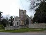 More images | [54] |
| Church of St Mary | Chilthorne Domer | Church | 13th century | ST5248219423 50°58′20″N 2°40′41″W / 50.97225°N 2.678141°W / 50.97225; -2.678141 (Church of St Mary) | 1345756 |  More images | [55] |
| Church of St Mary | Compton Pauncefoot | Church | Pre 1262 | ST6440226161 51°02′01″N 2°30′33″W / 51.0337°N 2.509043°W / 51.0337; -2.509043 (Church of St Mary) | 1248577 |  More images | [56] |
| Church of St Mary | Donyatt | Church | 15th century | ST3391614057 50°55′20″N 2°56′30″W / 50.922169°N 2.941556°W / 50.922169; -2.941556 (Church of St Mary) | 1057074 |  More images | [57] |
| Church of St Mary | Seavington St Mary | Church | 13th century | ST4028814920 50°55′50″N 2°51′04″W / 50.930625°N 2.851054°W / 50.930625; -2.851054 (Church of St Mary) | 1307339 | 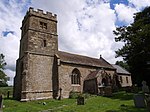 More images | [58] |
| Church of St Mary | Wambrook | Church | Pre 1613 | ST2939407707 50°51′52″N 3°00′17″W / 50.86454°N 3.004651°W / 50.86454; -3.004651 (Church of St Mary) | 1249439 |  More images | [59] |
| Church of St Mary | Yarlington | Church | 11th century | ST6546829309 51°03′43″N 2°29′39″W / 51.062072°N 2.494143°W / 51.062072; -2.494143 (Church of St Mary) | 1056212 |  More images | [60] |
| Church of St Mary | Hardington Mandeville | Church | Pre 1123 | ST5123211932 50°54′17″N 2°41′42″W / 50.904789°N 2.694937°W / 50.904789; -2.694937 (Church of St Mary) | 1345795 |  More images | [61] |
| Church of St Mary Magdalen | Cricket Malherbie, Knowle St Giles | Church | 1855 | ST3612911540 50°53′59″N 2°54′35″W / 50.899788°N 2.909634°W / 50.899788; -2.909634 (Church of St Mary Magdalen) | 1177461 |  More images | [62] |
| Church of St Mary Magdalene | Sparkford | Church | 14th century | ST6090725663 51°01′44″N 2°33′32″W / 51.028994°N 2.55883°W / 51.028994; -2.55883 (Church of St Mary Magdalene) | 1243352 |  More images | [63] |
| Church of St Mary Major | Ilchester | Church | 13th century | ST5225522613 51°00′03″N 2°40′54″W / 51.000915°N 2.681794°W / 51.000915; -2.681794 (Church of St Mary Major) | 1345741 |  More images | [64] |
| Church of St Mary the Virgin | Stocklinch | Church | 12th century | ST3866917084 50°57′00″N 2°52′28″W / 50.949912°N 2.874454°W / 50.949912; -2.874454 (Church of St Mary the Virgin) | 1175580 |  More images | [65] |
| Church of St Mary the Virgin | Whitelackington | Church | Early 14th century | ST3795615268 50°56′01″N 2°53′03″W / 50.933507°N 2.884292°W / 50.933507; -2.884292 (Church of St Mary the Virgin) | 1057033 |  More images | [66] |
| Church of St Mary Magdalene | Barwick | Church | 13th century | ST5580413856 50°55′21″N 2°37′49″W / 50.922458°N 2.630154°W / 50.922458; -2.630154 (Church of St Mary Magdalene) | 1057217 |  More images | [67] |
| Church of St Michael | Blackford | Church | 11th or 12th century | ST6579826160 51°02′02″N 2°29′21″W / 51.033776°N 2.489136°W / 51.033776; -2.489136 (Church of St Michael) | 1056557 |  More images | [68] |
| Church of St Michael | East Coker | Church | Late 12th century | ST5388312190 50°54′26″N 2°39′26″W / 50.907327°N 2.657271°W / 50.907327; -2.657271 (Church of St Michael) | 1345781 |  More images | [69] |
| Church of St Michael | Cudworth | Church | 12th century | ST3731310870 50°53′38″N 2°53′34″W / 50.893894°N 2.892684°W / 50.893894; -2.892684 (Church of St Michael) | 1366403 | 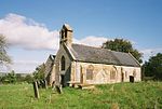 More images | [70] |
| Church of St Michael | Seavington St Michael | Church | 12th century | ST4101314947 50°55′51″N 2°50′27″W / 50.930942°N 2.840743°W / 50.930942; -2.840743 (Church of St Michael) | 1057002 | 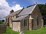 More images | [71] |
| Church of St Michael | Wayford | Church | 13th century | ST4048006655 50°51′23″N 2°50′49″W / 50.856331°N 2.846972°W / 50.856331; -2.846972 (Church of St Michael) | 1056166 |  More images | [72] |
| Church of St Michael and All Angels | Chaffcombe | Church | 1857-60 | ST3539410183 50°53′15″N 2°55′11″W / 50.887505°N 2.919844°W / 50.887505; -2.919844 (Church of St Michael and All Angels) | 1056177 | 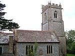 More images | [73] |
| Church of St Michael and All Angels | Haselbury Plucknett | Church | 14th century | ST4713610930 50°53′44″N 2°45′11″W / 50.895418°N 2.753039°W / 50.895418; -2.753039 (Church of St Michael and All Angels) | 1056149 |  More images | [74] |
| Church of St Michael and All Angels | Penselwood | Church | Mostly 15th century | ST7562331434 51°04′54″N 2°20′58″W / 51.081703°N 2.34938°W / 51.081703; -2.34938 (Church of St Michael and All Angels) | 1238353 |  More images | [75] |
| Church of St Nicholas | Bratton Seymour | Church | Saxon | ST6771130078 51°04′09″N 2°27′44″W / 51.069117°N 2.462206°W / 51.069117; -2.462206 (Church of St Nicholas) | 1177220 |  More images | [76] |
| Church of St Nicholas | Dinnington | Church | 1863 | ST4030212766 50°54′41″N 2°51′02″W / 50.911259°N 2.850501°W / 50.911259; -2.850501 (Church of St Nicholas) | 1345887 |  More images | [77] |
| Church of St Nicholas | Henstridge | Church | 12th century | ST7227919763 50°58′36″N 2°23′46″W / 50.976605°N 2.396221°W / 50.976605; -2.396221 (Church of St Nicholas) | 1366325 |  More images | [78] |
| Church of St Nicholas | Holton | Church | 14th century | ST6852826849 51°02′24″N 2°27′01″W / 51.040128°N 2.450264°W / 51.040128; -2.450264 (Church of St Nicholas) | 1056348 |  More images | [79] |
| Church of St Peter | Redlynch | Church | c. 1750 | ST6999433319 51°05′54″N 2°25′48″W / 51.098384°N 2.429894°W / 51.098384; -2.429894 (Church of St Peter) | 1176298 |  More images | [80] |
| Church of St Peter | Ilton | Church | 12th century | ST3518917423 50°57′09″N 2°55′27″W / 50.952578°N 2.924047°W / 50.952578; -2.924047 (Church of St Peter) | 1057052 |  More images | [81] |
| Church of St Peter | South Barrow | Church | 14th century | ST6018127892 51°02′56″N 2°34′10″W / 51.048987°N 2.569428°W / 51.048987; -2.569428 (Church of St Peter) | 1258889 |  More images | [82] |
| Church of St Peter and St Paul | Charlton Horethorne | Church | 12th century | ST6652423075 51°00′22″N 2°28′43″W / 51.006079°N 2.478497°W / 51.006079; -2.478497 (Church of St Peter and St Paul) | 1056366 |  More images | [83] |
| Church of St Peter and St Paul | Chiselborough | Church | 17th century | ST4674914873 50°55′51″N 2°45′33″W / 50.930836°N 2.759118°W / 50.930836; -2.759118 (Church of St Peter and St Paul) | 1345758 |  More images | [84] |
| Church of St Peter and St Paul | Odcombe | Church | 13th century | ST5069015466 50°56′11″N 2°42′11″W / 50.936519°N 2.703124°W / 50.936519; -2.703124 (Church of St Peter and St Paul) | 1241492 |  More images | [85] |
| Church of St Peter and St Paul | Wincanton | Church | 1793 | ST7110728484 51°03′18″N 2°24′49″W / 51.054966°N 2.413612°W / 51.054966; -2.413612 (Church of St Peter and St Paul) | 1238534 |  More images | [86] |
| Church of St Roch | Pendomer, Closworth | Church | 14th century | ST5213410394 50°53′28″N 2°40′55″W / 50.891035°N 2.681908°W / 50.891035; -2.681908 (Church of St Roch) | 1307971 |  More images | [87] |
| Church of St Stephen | Winsham | Church | 13th century | ST3746306273 50°51′09″N 2°53′23″W / 50.852577°N 2.889764°W / 50.852577; -2.889764 (Church of St Stephen) | 1177765 |  More images | [88] |
| Church of St Stephen | Charlton Musgrove | Church | 13th century | ST7201329909 51°04′04″N 2°24′03″W / 51.067825°N 2.400796°W / 51.067825; -2.400796 (Church of St Stephen) | 1346185 |  More images | [89] |
| Church of St Thomas | Cricket St Thomas | Church | 1868 | ST3728908584 50°52′24″N 2°53′33″W / 50.873337°N 2.892633°W / 50.873337; -2.892633 (Church of St Thomas) | 1056183 |  More images | [90] |
| Church of St Thomas à Becket | South Cadbury | Church | 13th century | ST6314125497 51°01′40″N 2°31′37″W / 51.02765°N 2.526958°W / 51.02765; -2.526958 (Church of St Thomas à Becket) | 1258922 |  More images | [91] |
| Church of St Thomas of Canterbury | Lovington | Church | 13th century | ST5966330835 51°04′31″N 2°34′38″W / 51.075413°N 2.577146°W / 51.075413; -2.577146 (Church of St Thomas of Canterbury) | 1056528 |  More images | [92] |
| Church of the Blessed Virgin Mary | Ashill | Church | 12th century | ST3211617263 50°57′03″N 2°58′04″W / 50.950785°N 2.967759°W / 50.950785; -2.967759 (Church of the Blessed Virgin Mary) | 1057100 |  More images | [93] |
| Church of the Holy Cross | Babcary | Church | 14th century | ST5614828774 51°03′24″N 2°37′37″W / 51.056623°N 2.627065°W / 51.056623; -2.627065 (Church of the Holy Cross) | 1277940 |  More images | [94] |
| Church of the Holy Cross | Weston Bampfylde, Sparkford | Church | 13th century | ST6105724942 51°01′21″N 2°33′24″W / 51.022522°N 2.556613°W / 51.022522; -2.556613 (Church of the Holy Cross) | 1243568 |  More images | [95] |
| Churchyard Cross in Churchyard of the Church of St Catherine | Drayton | Cross | 15th century | ST4051824760 51°01′09″N 2°50′58″W / 51.019123°N 2.849394°W / 51.019123; -2.849394 (Churchyard Cross in Churchyard of the Church of St Catherine) | 1236539 |  More images | [96] |
| Churchyard Cross, 10m west of the Church of All Saints | Closworth | Cross | 15th century | ST5476911124 50°53′52″N 2°38′40″W / 50.897812°N 2.644538°W / 50.897812; -2.644538 (Churchyard Cross, 10m west of the Church of All Saints) | 1307974 |  More images | [97] |
| Churchyard Cross, about 5m south of Nave, Church of St Aldhelm and St Eadburgha | Broadway | Cross | Late 13th century-Early 14th century | ST3296315896 50°56′19″N 2°57′20″W / 50.938594°N 2.955451°W / 50.938594; -2.955451 (Churchyard Cross, about 5m south of Nave, Church of St Aldhelm and St Eadburgha) | 1057005 | Upload Photo | [98] |
| Clapton Farmhouse | Cucklington | Farmhouse | 1615 | ST7513929201 51°03′42″N 2°21′22″W / 51.061603°N 2.356135°W / 51.061603; -2.356135 (Clapton Farmhouse) | 1222398 | Upload Photo | [99] |
| Clapton Mill (Lockyer and Son), with aqueduct to north east | West Crewkerne | Mill | Rebuilt 1864 | ST4137106378 50°51′14″N 2°50′03″W / 50.853931°N 2.834271°W / 50.853931; -2.834271 (Clapton Mill (Lockyer and Son), with aqueduct to north east) | 1056856 | 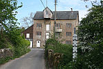 More images | [100] |
| Collins Chest Tomb, 2m south of the south east Nave window, Church of All Saints | Closworth | Chest tomb | 1609 | ST5638110049 50°53′18″N 2°37′17″W / 50.88827°N 2.621489°W / 50.88827; -2.621489 (Collins Chest Tomb, 2m south of the south east Nave window, Church of All Saints) | 1345791 | | [101] |
| Congregational Chapel, now United Reformed Church | Kingsbury Episcopi | Chapel | 1729 | ST4225518447 50°57′45″N 2°49′25″W / 50.962538°N 2.823627°W / 50.962538; -2.823627 (Congregational Chapel, now United Reformed Church) | 1236948 |  | [102] |
| Coombe Hill House | Bruton | House | 1820-1830 | ST6837735529 51°07′05″N 2°27′11″W / 51.118169°N 2.45318°W / 51.118169; -2.45318 (Coombe Hill House) | 1346172 | Upload Photo | [103] |
| Cosenes Monument in Churchyard 5 metres south south east of South Transept, Church of All Saints | Castle Cary | Chest tomb | 16th century | ST6393632046 51°05′12″N 2°30′59″W / 51.086588°N 2.516277°W / 51.086588; -2.516277 (Cosenes Monument in Churchyard 5 metres south south east of South Transept, Church of All Saints) | 1366395 | Upload Photo | [104] |
| Court Farm House | Barwick | Farmhouse | Early 17th century | ST5639713545 50°55′11″N 2°37′18″W / 50.919707°N 2.62168°W / 50.919707; -2.62168 (Court Farm House) | 1057226 | Upload Photo | [105] |
| Court House | Martock | House | Late 16th century | ST4611219091 50°58′07″N 2°46′08″W / 50.968703°N 2.768807°W / 50.968703; -2.768807 (Court House) | 1227536 |  More images | [106] |
| Court House | South Petherton | House | 18th century | ST4321217051 50°57′00″N 2°48′35″W / 50.950081°N 2.809784°W / 50.950081; -2.809784 (Court House) | 1056954 | Upload Photo | [107] |
| Craigmore House | Somerton | House | 17th-18th century | ST4912128616 51°03′17″N 2°43′38″W / 51.054621°N 2.727298°W / 51.054621; -2.727298 (Craigmore House) | 1307586 | Upload Photo | [108] |
| Crane Farmhouse | Somerton | Farmhouse | Medieval | ST4903728337 51°03′08″N 2°43′42″W / 51.052105°N 2.728457°W / 51.052105; -2.728457 (Crane Farmhouse) | 1346065 | Upload Photo | [109] |
| Cricket Court, and attached balustraded walling around basement areas | Cricket Malherbie | House | 1811 | ST3601111414 50°53′55″N 2°54′41″W / 50.898642°N 2.91129°W / 50.898642; -2.91129 (Cricket Court, and attached balustraded walling around basement areas) | 1056158 | Upload Photo | [110] |
| Danyell Monument in churchyard about 0.5 metres south of Chancel, Church of St Thomas of Canterbury | Lovington | Chest tomb | Early 17th century | ST5967630830 51°04′31″N 2°34′37″W / 51.075369°N 2.57696°W / 51.075369; -2.57696 (Danyell Monument in churchyard about 0.5 metres south of Chancel, Church of St Thomas of Canterbury) | 1277744 | Upload Photo | [111] |
| Darvole Farm House | East Coker | Farmhouse | 16th century | ST5562212418 50°54′34″N 2°37′57″W / 50.909514°N 2.632567°W / 50.909514; -2.632567 (Darvole Farm House) | 1176487 | Upload Photo | [112] |
| Dental Surgery / Priors House | Wincanton | House | 15th century | ST7124228567 51°03′21″N 2°24′42″W / 51.055719°N 2.411692°W / 51.055719; -2.411692 (Dental Surgery / Priors House) | 1238517 | Upload Photo | [113] |
| Dillington House | Whitelackington | House | 16th century | ST3676515552 50°56′09″N 2°54′05″W / 50.935931°N 2.901288°W / 50.935931; -2.901288 (Dillington House) | 1057040 |  More images | [114] |
| Donisthorpe | Somerton | House | Earlier | ST4909528681 51°03′19″N 2°43′40″W / 51.055203°N 2.727678°W / 51.055203; -2.727678 (Donisthorpe) | 1056687 | Upload Photo | [115] |
| Dovecote about 370 metres south of Bruton Church | Bruton | Dovecote | 16th century | ST6838534419 51°06′29″N 2°27′11″W / 51.108189°N 2.452968°W / 51.108189; -2.452968 (Dovecote about 370 metres south of Bruton Church) | 1056424 |  More images | [116] |
| Dovecote in Churchyard, about 15m south west of church, Church of St Mary The Virgin | Norton Sub Hamdon | Dovecote | 17th century | ST4703515946 50°56′26″N 2°45′19″W / 50.94051°N 2.755205°W / 50.94051; -2.755205 (Dovecote in Churchyard, about 15m south west of church, Church of St Mary The Virgin) | 1241076 |  More images | [117] |
| Dowlish Manor Farmhouse | Dowlish Wake | House | 11th century | ST3760812953 50°54′46″N 2°53′20″W / 50.912655°N 2.888847°W / 50.912655; -2.888847 (Dowlish Manor Farmhouse) | 1366406 | Upload Photo | [118] |
| East Lambrook Manor and forecourt wall / Manor Cottage | Kingsbury Episcopi | House | 15th century | ST4316918898 50°58′00″N 2°48′38″W / 50.966684°N 2.810685°W / 50.966684; -2.810685 (East Lambrook Manor and forecourt wall / Manor Cottage) | 1264346 |  More images | [119] |
| Easton House and forecourt wall | Barrington | House | c. 1600 | ST3939918060 50°57′32″N 2°51′51″W / 50.958765°N 2.864226°W / 50.958765; -2.864226 (Easton House and forecourt wall) | 1236314 | Upload Photo | [120] |
| Essex House | Chard | House | Mid 18th century | ST3238908636 50°52′24″N 2°57′44″W / 50.873251°N 2.962272°W / 50.873251; -2.962272 (Essex House) | 1297112 | Upload Photo | [121] |
| Factory Building, formerly of Gifford Fox and Company Limited | Chard | Factory | 1820-1830 | ST3223808450 50°52′18″N 2°57′52″W / 50.871561°N 2.964383°W / 50.871561; -2.964383 (Factory Building, formerly of Gifford Fox and Company Limited) | 1197481 | Upload Photo | [122] |
| Former Priests House | Wayford | House | 15th century | ST4048106625 50°51′22″N 2°50′49″W / 50.856061°N 2.846953°W / 50.856061; -2.846953 (Former Priests House) | 1056167 | Upload Photo | [123] |
| Front boundary wall, piers and gate, 15 metres north of Manor Farm House | Charlton Horethorne | Farmhouse | 18th century | ST6650723168 51°00′25″N 2°28′43″W / 51.006914°N 2.478748°W / 51.006914; -2.478748 (Front boundary wall, piers and gate, 15 metres north of Manor Farm House) | 1174379 |  | [124] |
| Gants Mill | Pitcombe | Mill | 1810-c. 1830 | ST6744434262 51°06′24″N 2°27′59″W / 51.106724°N 2.466395°W / 51.106724; -2.466395 (Gants Mill) | 1251831 |  More images | [125] |
| Gatehouse to Cathanger | Fivehead | Gatehouse | Late 16th century | ST3417522850 51°00′05″N 2°56′22″W / 51.001258°N 2.939465°W / 51.001258; -2.939465 (Gatehouse to Cathanger) | 1249561 | Upload Photo | [126] |
| Gate-piers and boundary walling to the Manor House and Mallet Court, bounding gardens | Curry Mallet | House | 16th century | ST3287421893 50°59′33″N 2°57′28″W / 50.992503°N 2.957826°W / 50.992503; -2.957826 (Gate-piers and boundary walling to the Manor House and Mallet Court, bounding gardens) | 1248996 | Upload Photo | [127] |
| Gazebo, Steps, Terraces and Walls to North West of Merefield House | Crewkerne | Wall | Early 18th century | ST4425109860 50°53′08″N 2°47′38″W / 50.885525°N 2.793893°W / 50.885525; -2.793893 (Gazebo, Steps, Terraces and Walls to North West of Merefield House) | 1208228 | Upload Photo | [128] |
| George Hotel | Ilminster | Hotel | Mid 17th century | ST3610014567 50°55′37″N 2°54′38″W / 50.927001°N 2.910578°W / 50.927001; -2.910578 (George Hotel) | 1298349 | 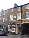 | [129] |
| Godminster Manor | Pitcombe | House | 15th century | ST6837433007 51°05′44″N 2°27′11″W / 51.095491°N 2.453001°W / 51.095491; -2.453001 (Godminster Manor) | 1251806 | Upload Photo | [130] |
| Group of eight Monuments in Churchyard, South and West of Nave, Church of St Andrew | Brympton d'Evercy | Tombs | 17th century | ST5191215372 50°56′09″N 2°41′09″W / 50.935778°N 2.685722°W / 50.935778; -2.685722 (Group of eight Monuments in Churchyard, South and West of Nave, Church of St Andrew) | 1263241 |  More images | [131] |
| Hadspen House | Pitcombe | House | 18th century | ST6603631044 51°04′40″N 2°29′10″W / 51.077706°N 2.486202°W / 51.077706; -2.486202 (Hadspen House) | 1251809 | Upload Photo | [132] |
| Haselbury Old Bridge | Haselbury Plucknett | Bridge | 14th century | ST4584710969 50°53′44″N 2°46′17″W / 50.895649°N 2.771371°W / 50.895649; -2.771371 (Haselbury Old Bridge) | 1056146 | Upload Photo | [133] |
| Heale House | Curry Rivel | House | 17th century | ST3915225268 51°01′25″N 2°52′08″W / 51.023547°N 2.868952°W / 51.023547; -2.868952 (Heale House) | 1249228 | Upload Photo | [134] |
| Hendford Manor | Yeovil | House | C. 1720 | ST5543215722 50°56′21″N 2°38′08″W / 50.939208°N 2.635674°W / 50.939208; -2.635674 (Hendford Manor) | 1296434 | 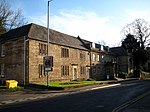 | [135] |
| Henley Manor Farmhouse | West Crewkerne | Farmhouse | Early 17th century | ST4394407683 50°51′57″N 2°47′53″W / 50.865921°N 2.797922°W / 50.865921; -2.797922 (Henley Manor Farmhouse) | 1175987 | Upload Photo | [136] |
| Hey Farmhouse | Winsham | Farmhouse | c. 1500 | ST3879506459 50°51′16″N 2°52′15″W / 50.854392°N 2.870876°W / 50.854392; -2.870876 (Hey Farmhouse) | 1307250 | Upload Photo | [137] |
| High Leaze Farmhouse | Brympton | Farmhouse | 17th century | ST5186516036 50°56′30″N 2°41′11″W / 50.941744°N 2.686479°W / 50.941744; -2.686479 (High Leaze Farmhouse) | 1345772 |  More images | [138] |
| Higher Farmhouse | Dowlish Wake | Farmhouse | Late 16th century | ST3756612641 50°54′35″N 2°53′22″W / 50.909845°N 2.889391°W / 50.909845; -2.889391 (Higher Farmhouse) | 1240334 | Upload Photo | [139] |
| Hinton House (South Range) | Hinton St George | House | Medieval | ST4181412367 50°54′28″N 2°49′44″W / 50.907826°N 2.828934°W / 50.907826; -2.828934 (Hinton House (South Range)) | 1175284 |  More images | [140] |
| Home Farmhouse and Farm Buildings attached to North East corner of Brympton House | Brympton | Farmhouse | 18th century | ST5200815461 50°56′12″N 2°41′04″W / 50.936586°N 2.684368°W / 50.936586; -2.684368 (Home Farmhouse and Farm Buildings attached to North East corner of Brympton House) | 1057267 | Upload Photo | [141] |
| Homefield | Norton Sub Hamdon | House | 16th century | ST4719015933 50°56′25″N 2°45′11″W / 50.940408°N 2.752997°W / 50.940408; -2.752997 (Homefield) | 1241341 | Upload Photo | [142] |
| Honeywick | Pitcombe | Farmhouse | 18th century | ST6531332489 51°05′26″N 2°29′48″W / 51.090656°N 2.496661°W / 51.090656; -2.496661 (Honeywick) | 1262425 | Upload Photo | [143] |
| Hurds Mill House and Courtyard Walling | Curry Rivel | House | Late 18th century | ST4122826489 51°02′05″N 2°50′22″W / 51.034742°N 2.839554°W / 51.034742; -2.839554 (Hurds Mill House and Courtyard Walling) | 1249226 | Upload Photo | [144] |
| Key Farm House | East Coker | Farmhouse | c. 1600 | ST5563813418 50°55′07″N 2°37′57″W / 50.918507°N 2.632462°W / 50.918507; -2.632462 (Key Farm House) | 1057188 | Upload Photo | [145] |
| Kincora and attached railings | Crewkerne | House | 17th century | ST4406409752 50°53′04″N 2°47′48″W / 50.884536°N 2.796534°W / 50.884536; -2.796534 (Kincora and attached railings) | 1281924 | Upload Photo | [146] |
| Kingstone Farmhouse | Kingstone | Farmhouse | Early 16th century | ST3781513669 50°55′09″N 2°53′10″W / 50.919115°N 2.886025°W / 50.919115; -2.886025 (Kingstone Farmhouse) | 1056988 | Upload Photo | [147] |
| Lancin Farmhouse | Wambrook | Farmhouse | Late medieval | ST2846407980 50°52′01″N 3°01′05″W / 50.86688°N 3.017917°W / 50.86688; -3.017917 (Lancin Farmhouse) | 1277516 | Upload Photo | [148] |
| Langford Fivehead | Fivehead | House | 1905 | ST4316918898 50°58′00″N 2°48′38″W / 50.966684°N 2.810685°W / 50.966684; -2.810685 (Langford Fivehead) | 1263649 | Upload Photo | [149] |
| Leigh House | Winsham | House | 15th century | ST3558506210 50°51′06″N 2°54′59″W / 50.851804°N 2.916428°W / 50.851804; -2.916428 (Leigh House) | 1056141 | Upload Photo | [150] |
| Lockyer's Farmhouse | Compton Dundon | Farmhouse | Medieval | ST4789432301 51°05′16″N 2°44′43″W / 51.087644°N 2.745335°W / 51.087644; -2.745335 (Lockyer's Farmhouse) | 1307775 | Upload Photo | [151] |
| Long Load Bridge | Long Load | Bridge | Medieval | ST4670223792 51°00′40″N 2°45′40″W / 51.011027°N 2.761097°W / 51.011027; -2.761097 (Long Load Bridge) | 1267215 |  More images | [152] |
| Lower Cockhill Farmhouse, with Mounting Block 5 metres West | Castle Cary | Farmhouse | Late 15th century/early 16th century | ST6252431180 51°04′43″N 2°32′11″W / 51.07871°N 2.536346°W / 51.07871; -2.536346 (Lower Cockhill Farmhouse, with Mounting Block 5 metres West) | 1177369 | Upload Photo | [153] |
| Lullingstone | Winsham | House | 16th century | ST3751106405 50°51′14″N 2°53′21″W / 50.853769°N 2.889105°W / 50.853769; -2.889105 (Lullingstone) | 1056176 | Upload Photo | [154] |
| Madey Mill | Martock | Watermill | Medieval | ST4674719058 50°58′06″N 2°45′35″W / 50.968465°N 2.75976°W / 50.968465; -2.75976 (Madey Mill) | 1226550 |  | [155] |
| Main Building of the former Parrett Iron Works | Martock | Foundry | Maybe 18th century | ST4459818633 50°57′52″N 2°47′25″W / 50.964441°N 2.790296°W / 50.964441; -2.790296 (Main Building of the former Parrett Iron Works) | 1225080 |  More images | [156] |
| Manning Chest Tomb, in Churchyard 4 metres South of South East Corner Church of St John the Baptist | Brewham | Chest Tomb | 1618 | ST7198236142 51°07′26″N 2°24′06″W / 51.123869°N 2.401724°W / 51.123869; -2.401724 (Manning Chest Tomb, in Churchyard 4 metres South of South East Corner Church of St John the Baptist) | 1056464 | Upload Photo | [157] |
| Mannings | Stocklinch | Farmhouse | 15th century | ST3825917236 50°57′04″N 2°52′49″W / 50.951234°N 2.880315°W / 50.951234; -2.880315 (Mannings) | 1308307 | Upload Photo | [158] |
| Manor Farm House | Charlton Horethorne | House | 1608 | ST6652223145 51°00′24″N 2°28′43″W / 51.006708°N 2.478532°W / 51.006708; -2.478532 (Manor Farm House) | 1056363 | | [159] |
| Manor Farm House | Mudford | House | 1630 | ST5774718897 50°58′05″N 2°36′11″W / 50.967932°N 2.603098°W / 50.967932; -2.603098 (Manor Farm House) | 1056802 | Upload Photo | [160] |
| Manor Farmhouse | Beercrocombe | Farmhouse | 1600 | ST3230620594 50°58′51″N 2°57′56″W / 50.980757°N 2.965676°W / 50.980757; -2.965676 (Manor Farmhouse) | 1249063 | Upload Photo | [161] |
| Manor Farmhouse | Charlton Mackrell | Farmhouse | Medieval | ST5293328572 51°03′16″N 2°40′22″W / 51.054552°N 2.672908°W / 51.054552; -2.672908 (Manor Farmhouse) | 1056724 | Upload Photo | [162] |
| Manor Farmhouse | High Ham | Farmhouse | 17th century | ST4261231155 51°04′37″N 2°49′14″W / 51.076835°N 2.82056°W / 51.076835; -2.82056 (Manor Farmhouse) | 1235211 | Upload Photo | [163] |
| Manor Farmhouse | Tatworth and Forton | Farmhouse | Late Medieval | ST3357006992 50°51′31″N 2°56′43″W / 50.858607°N 2.945191°W / 50.858607; -2.945191 (Manor Farmhouse) | 1248812 | Upload Photo | [164] |
| Manor Farmhouse | West and Middle Chinnock | Farmhouse | Late 16th century/early 17th century | ST4731713286 50°55′00″N 2°45′03″W / 50.916619°N 2.750806°W / 50.916619; -2.750806 (Manor Farmhouse) | 1057127 | Upload Photo | [165] |
| Manor Farmhouse and front boundary railings | Ash | Farmhouse | Early 17th century | ST4793120570 50°58′56″N 2°44′35″W / 50.982169°N 2.743117°W / 50.982169; -2.743117 (Manor Farmhouse and front boundary railings) | 1056534 | Upload Photo | [166] |
| Manor House | Abbas and Templecombe | House | 17th century | ST7091922094 50°59′51″N 2°24′57″W / 50.997498°N 2.415779°W / 50.997498; -2.415779 (Manor House) | 1056356 | Upload Photo | [167] |
| Manor House | Marston Magna | House | 1613 | ST5930322306 50°59′55″N 2°34′53″W / 50.998697°N 2.581324°W / 50.998697; -2.581324 (Manor House) | 1056828 | Upload Photo | [168] |
| Manor House | Misterton | House | Mid 18th century | ST4533408165 50°52′13″N 2°46′42″W / 50.870388°N 2.778245°W / 50.870388; -2.778245 (Manor House) | 1308208 | Upload Photo | [169] |
| Manor House, King Ina's Palace | South Petherton | House | 16th century | ST4332917091 50°57′02″N 2°48′29″W / 50.950453°N 2.808124°W / 50.950453; -2.808124 (Manor House, King Ina's Palace) | 1056956 | Upload Photo | [170] |
| Maperton House | Maperton | House | 1802 | ST6717226190 51°02′03″N 2°28′10″W / 51.034126°N 2.469544°W / 51.034126; -2.469544 (Maperton House) | 1177942 | Upload Photo | [171] |
| Merefield House | Crewkerne | House | Mid 17th century | ST4427909859 50°53′08″N 2°47′37″W / 50.885519°N 2.793495°W / 50.885519; -2.793495 (Merefield House) | 1208219 | Upload Photo | [172] |
| Mid Lambrook Manor | Kingsbury Episcopi | Farmhouse | c. 1500 | ST4227118384 50°57′43″N 2°49′24″W / 50.961973°N 2.82339°W / 50.961973; -2.82339 (Mid Lambrook Manor) | 1264344 |  | [173] |
| Middlethorpe House | Curry Rivel | House | 17th century | ST3909525016 51°01′17″N 2°52′11″W / 51.021275°N 2.869722°W / 51.021275; -2.869722 (Middlethorpe House) | 1249233 | Upload Photo | [174] |
| Mill, attached House and former Drying Kiln | West Crewkerne | Watermill | 1793 | ST4191707942 50°52′05″N 2°49′36″W / 50.868049°N 2.826764°W / 50.868049; -2.826764 (Mill, attached House and former Drying Kiln) | 1400079 | Upload Photo | [175] |
| Monks' Reredorter, Muchelney Abbey | Muchelney | Privy House | 13th century | ST4287324820 51°01′12″N 2°48′57″W / 51.019902°N 2.815833°W / 51.019902; -2.815833 (Monks' Reredorter, Muchelney Abbey) | 1056573 | 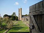 More images | [176] |
| Monmouth House and attached Walls and Railings | Chard | House | 1770-1790 | ST3245108656 50°52′24″N 2°57′41″W / 50.873438°N 2.961395°W / 50.873438; -2.961395 (Monmouth House and attached Walls and Railings) | 1205613 |  | [177] |
| Naish's Farm House, with front boundary wall and gate piers | West Camel | Farmhouse | Early 18th century | ST5767324571 51°01′08″N 2°36′17″W / 51.018946°N 2.604815°W / 51.018946; -2.604815 (Naish's Farm House, with front boundary wall and gate piers) | 1345993 | Upload Photo | [178] |
| National Westminster Bank | Crewkerne | Bank | 1838 | ST4409009737 50°53′04″N 2°47′46″W / 50.884404°N 2.796163°W / 50.884404; -2.796163 (National Westminster Bank) | 1208423 |  More images | [179] |
| 3 (Hayes End Manor), 5 and 7, Hayes End | South Petherton | House | c. 1600 | ST4360716684 50°56′49″N 2°48′15″W / 50.94682°N 2.804104°W / 50.94682; -2.804104 (3 (Hayes End Manor), 5 and 7, Hayes End) | 1056974 |  | [180] |
| 18 and 20, High Street | Bruton | House | 16th century | ST6831534867 51°06′44″N 2°27′14″W / 51.112213°N 2.454007°W / 51.112213; -2.454007 (18 and 20, High Street) | 1056419 | Upload Photo | [181] |
| 17, North Street | Chiselborough | House | Possibly Late 16th century | ST4691414986 50°55′55″N 2°45′24″W / 50.931867°N 2.756787°W / 50.931867; -2.756787 (17, North Street) | 1251532 | Upload Photo | [182] |
| 9, Church Street | Crewkerne | House | Mid 19th century | ST4402409757 50°53′04″N 2°47′50″W / 50.884577°N 2.797104°W / 50.884577; -2.797104 (9, Church Street) | 1202987 | Upload Photo | [183] |
| 29, Court Barton | Ilminster | House | Early 16th century | ST3603814615 50°55′39″N 2°54′41″W / 50.927426°N 2.911468°W / 50.927426; -2.911468 (29, Court Barton) | 1207652 | Upload Photo | [184] |
| 28, Court Barton | Ilminster | House | 1586 | ST3603714614 50°55′39″N 2°54′41″W / 50.927417°N 2.911482°W / 50.927417; -2.911482 (28, Court Barton) | 1298320 | Upload Photo | [185] |
| 21, Woolston Road | North Cadbury | House | 15th century | ST6355527247 51°02′36″N 2°31′16″W / 51.043412°N 2.521232°W / 51.043412; -2.521232 (21, Woolston Road) | 1056206 | Upload Photo | [186] |
| North Perrott Manor House / Perrott Hill School | North Perrott | House | 1877 | ST4675509645 50°53′02″N 2°45′30″W / 50.883829°N 2.758268°W / 50.883829; -2.758268 (North Perrott Manor House / Perrott Hill School) | 1175931 |  More images | [187] |
| 2 and 3, and attached railings, gate piers and gates | Whitelackington | House | Early 19th century | ST3654814579 50°55′38″N 2°54′15″W / 50.927159°N 2.904206°W / 50.927159; -2.904206 (2 and 3, and attached railings, gate piers and gates) | 1195064 | Upload Photo | [188] |
| 19–21, attached gateway and outbuildings to the rear of No. 19, Silver Street | Ilminster | House | Possible 17th century | ST3603714516 50°55′36″N 2°54′41″W / 50.926536°N 2.911465°W / 50.926536; -2.911465 (19–21, attached gateway and outbuildings to the rear of No. 19, Silver Street) | 1208520 | Upload Photo | [189] |
| Old Somerton Mill | Somerton | House | 16th century | ST4981628475 51°03′12″N 2°43′03″W / 51.053415°N 2.717363°W / 51.053415; -2.717363 (Old Somerton Mill) | 1346032 | Upload Photo | [190] |
| Oscars | Crewkerne | House | Early 16th century | ST4410409827 50°53′07″N 2°47′46″W / 50.885214°N 2.795977°W / 50.885214; -2.795977 (Oscars) | 1202968 | Upload Photo | [191] |
| Oxenford House, and the cottage attached to west gable with pump | Dowlish Wake | Farmhouse | 17th century | ST359124 50°54′30″N 2°54′44″W / 50.9082°N 2.9121°W / 50.9082; -2.9121 (Oxenford House, and the cottage attached to west gable with pump) | 1307531 | Upload Photo | [192] |
| Pavyotts Mill House | East Coker | Mill House | c. 1600 | ST5516813249 50°55′01″N 2°38′21″W / 50.916951°N 2.639127°W / 50.916951; -2.639127 (Pavyotts Mill House) | 1307789 |  | [193] |
| Pen Pits | Penselwood | House | 1935 | ST7670731532 51°04′57″N 2°20′02″W / 51.082629°N 2.333912°W / 51.082629; -2.333912 (Pen Pits) | 1274243 | Upload Photo | [194] |
| Penny Tombstone, in churchyard 11 metres south of chancel, Church of St Peter and St Paul | Charlton Horethorne | Tombstone | Late 17th century | ST6654323055 51°00′21″N 2°28′42″W / 51.0059°N 2.478224°W / 51.0059; -2.478224 (Penny Tombstone, in churchyard 11 metres south of chancel, Church of St Peter and St Paul) | 1056367 | Upload Photo | [195] |
| Physicwell House | Stoke Trister | Farmhouse | Converted 1819 | ST7278327898 51°02′59″N 2°23′23″W / 51.049779°N 2.389655°W / 51.049779; -2.389655 (Physicwell House) | 1238359 | Upload Photo | [196] |
| Pittards Farmhouse | Kingsbury Episcopi | Farmhouse | 17th century | ST4329018759 50°57′56″N 2°48′32″W / 50.965446°N 2.80894°W / 50.965446; -2.80894 (Pittards Farmhouse) | 1345545 | Upload Photo | [197] |
| Prankerd Chest Tomb, in churchyard 7 metres south east of south door, Church of St John Evangelist | Milborne Port | Chest Tomb | Early 17th century | ST6764318521 50°57′55″N 2°27′44″W / 50.965194°N 2.462141°W / 50.965194; -2.462141 (Prankerd Chest Tomb, in churchyard 7 metres south east of south door, Church of St John Evangelist) | 1174727 | Upload Photo | [198] |
| Priory Farmhouse | Hinton St George | House | 14th century/15th century | ST4199012599 50°54′36″N 2°49′35″W / 50.90993°N 2.826468°W / 50.90993; -2.826468 (Priory Farmhouse) | 1175241 | Upload Photo  More images | [199] |
| Privy about 35 metres south of the Manor House | Chilthorne Domer | Privy House | Mid 18th century | ST5239518921 50°58′04″N 2°40′46″W / 50.967729°N 2.679314°W / 50.967729; -2.679314 (Privy about 35 metres south of the Manor House) | 1057248 | Upload Photo | [200] |
| Red Lion Hotel, with front boundary railings attached | Somerton | Hotel | 17th/18th century | ST4911328551 51°03′15″N 2°43′39″W / 51.054036°N 2.727403°W / 51.054036; -2.727403 (Red Lion Hotel, with front boundary railings attached) | 1177452 |  | [201] |
| Rodwell Manor | Kingsbury Episcopi | House | 1988 | ST4095018945 50°58′01″N 2°50′32″W / 50.966883°N 2.842289°W / 50.966883; -2.842289 (Rodwell Manor) | 1264305 |  More images | [202] |
| Rowland's Farm House, and attached outbuildings around courtyard on north side, including well | Ashill | Farmhouse | c. 1750 | ST3430716359 50°56′34″N 2°56′11″W / 50.942912°N 2.93641°W / 50.942912; -2.93641 (Rowland's Farm House, and attached outbuildings around courtyard on north side, including well) | 1057097 | Upload Photo | [203] |
| Rowland's Mill | Ashill | Mill House | Late 17th century | ST3446816210 50°56′30″N 2°56′03″W / 50.94159°N 2.934091°W / 50.94159; -2.934091 (Rowland's Mill) | 1345847 | Upload Photo | [204] |
| Stable block about 70 metres west of Brympton House | Brympton | House | c. 1720 | ST5186315446 50°56′11″N 2°41′11″W / 50.936439°N 2.686429°W / 50.936439; -2.686429 (Stable block about 70 metres west of Brympton House) | 1057265 |  More images | [205] |
| Standerwick Farm | Babcary | Farmhouse | c. 1400 | ST5820629174 51°03′37″N 2°35′52″W / 51.060374°N 2.597749°W / 51.060374; -2.597749 (Standerwick Farm) | 1248456 | Upload Photo | [206] |
| Stapleton Farmhouse | Martock | Farmhouse | Medieval | ST4633921001 50°59′09″N 2°45′57″W / 50.985898°N 2.765857°W / 50.985898; -2.765857 (Stapleton Farmhouse) | 1227081 | Upload Photo | [207] |
| Stembridge Mill | High Ham | Mill | 1897 | ST4328230517 51°04′16″N 2°48′39″W / 51.071165°N 2.810896°W / 51.071165; -2.810896 (Stembridge Mill) | 1235260 | 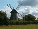 More images | [208] |
| Stocklinch Grove | Stocklinch | House | 1653 | ST3831117106 50°57′00″N 2°52′46″W / 50.950071°N 2.879553°W / 50.950071; -2.879553 (Stocklinch Grove) | 1345871 | Upload Photo | [209] |
| United Reformed Church | Stoke-sub-Hamdon | Church | 1866 | ST4733417531 50°57′17″N 2°45′04″W / 50.95479°N 2.75118°W / 50.95479; -2.75118 (United Reformed Church) | 1260181 | 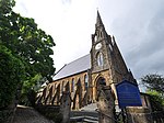 More images | [210] |
| Summerhouse about 15 metres north west of the Manor House | Norton Sub Hamdon | House | 18th century | ST4677115935 50°56′25″N 2°45′32″W / 50.940387°N 2.75896°W / 50.940387; -2.75896 (Summerhouse about 15 metres north west of the Manor House) | 1241090 | Upload Photo | [211] |
| Swadel Chest Tomb, 8 metres south of the south door of the chancel, Church of St Peter | Yeovilton | Chest Tomb | 1593 | ST5456124910 51°01′18″N 2°38′57″W / 51.021756°N 2.649222°W / 51.021756; -2.649222 (Swadel Chest Tomb, 8 metres south of the south door of the chancel, Church of St Peter) | 1175211 | Upload Photo | [212] |
| The Chantry | Ilminster | House | Mid 15th century | ST3598814606 50°55′38″N 2°54′44″W / 50.927339°N 2.912178°W / 50.927339; -2.912178 (The Chantry) | 1207664 | Upload Photo | [213] |
| The Chantry | Martock | House | 14th century | ST4620619170 50°58′10″N 2°46′03″W / 50.969422°N 2.76748°W / 50.969422; -2.76748 (The Chantry) | 1066030 | Upload Photo | [214] |
| The Choughs Public House | Chard | House | Early 17th century or late 16th century | ST3206408593 50°52′22″N 2°58′01″W / 50.872826°N 2.966882°W / 50.872826; -2.966882 (The Choughs Public House) | 1280479 | 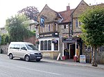 More images | [215] |
| The Coign | Rimpton | House | 16th century | ST6085721642 50°59′34″N 2°33′33″W / 50.992835°N 2.559108°W / 50.992835; -2.559108 (The Coign) | 1295557 | Upload Photo | [216] |
| The Court | Charlton Mackrell | House | 1792 | ST5279028444 51°03′12″N 2°40′30″W / 51.053389°N 2.674931°W / 51.053389; -2.674931 (The Court) | 1056732 | Upload Photo | [217] |
| The Dovecot, 30 metres north east of Godminster Manor | Pitcombe | Dovecote | 17th century | ST6840833030 51°05′45″N 2°27′09″W / 51.0957°N 2.452518°W / 51.0957; -2.452518 (The Dovecot, 30 metres north east of Godminster Manor) | 1251807 | Upload Photo | [218] |
| The Dower House | Tintinhull | House | Later 17th century | ST5000719795 50°58′31″N 2°42′48″W / 50.975385°N 2.713439°W / 50.975385; -2.713439 (The Dower House) | 1227288 | Upload Photo | [219] |
| The former ropewalk 75 metres north west of Millbrook House | West Coker | Ropewalk | c. 1886 | ST5121713698 50°55′14″N 2°41′43″W / 50.920667°N 2.695387°W / 50.920667; -2.695387 (The former ropewalk 75 metres north west of Millbrook House) | 1057092 | Upload Photo | [220] |
| The Gables | Stoke-sub-Hamdon | House | c. 1600 | ST4739417644 50°57′21″N 2°45′01″W / 50.955811°N 2.750342°W / 50.955811; -2.750342 (The Gables) | 1242144 | Upload Photo | [221] |
| The Garden Sculpture, 20 metres north of porch to Shanks House | Cucklington | Sculpture | Probably 18th century | ST7534226684 51°02′20″N 2°21′11″W / 51.038979°N 2.353066°W / 51.038979; -2.353066 (The Garden Sculpture, 20 metres north of porch to Shanks House) | 1056388 | Upload Photo | [222] |
| The Granary, 20 metres east of Godminster Manor | Pitcombe | Granary | 18th century | ST6840633008 51°05′44″N 2°27′09″W / 51.095502°N 2.452544°W / 51.095502; -2.452544 (The Granary, 20 metres east of Godminster Manor) | 1251988 | Upload Photo | [223] |
| The Grotto at Jordans | Ashill | Grotto | 1828 | ST3388016010 50°56′23″N 2°56′33″W / 50.939725°N 2.942423°W / 50.939725; -2.942423 (The Grotto at Jordans) | 1057070 | Upload Photo | [224] |
| The Guildhall | Chard | Corn Exchange | 1834 | ST3222308558 50°52′21″N 2°57′53″W / 50.87253°N 2.964616°W / 50.87253; -2.964616 (The Guildhall) | 1197456 | 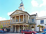 More images | [225] |
| The Hext Almshouses | Somerton | Almshouse | 1626 | ST4880728508 51°03′13″N 2°43′54″W / 51.053622°N 2.731762°W / 51.053622; -2.731762 (The Hext Almshouses) | 1295258 |  More images | [226] |
| The Langport Arms Hotel | Langport | Hotel | 16th century | ST4199426756 51°02′14″N 2°49′43″W / 51.03722°N 2.828674°W / 51.03722; -2.828674 (The Langport Arms Hotel) | 1056611 | 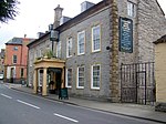 More images | [227] |
| The Limes | Curry Rivel | House | Early 18th century | ST3894625312 51°01′26″N 2°52′19″W / 51.023921°N 2.871896°W / 51.023921; -2.871896 (The Limes) | 1249458 | Upload Photo | [228] |
| The Lodge, about 165m south-south-west of Montacute House | Montacute | House | 16th century | ST4981917011 50°57′01″N 2°42′57″W / 50.950336°N 2.715732°W / 50.950336; -2.715732 (The Lodge, about 165m south-south-west of Montacute House) | 1252028 |  More images | [229] |
| The Manor House | Barton St David | House | 19th century | ST5418932358 51°05′19″N 2°39′20″W / 51.088695°N 2.65547°W / 51.088695; -2.65547 (The Manor House) | 1176131 | Upload Photo | [230] |
| The Manor House | Bruton | House | 15th century | ST6617434296 51°06′25″N 2°29′04″W / 51.106956°N 2.484537°W / 51.106956; -2.484537 (The Manor House) | 1366340 | Upload Photo | [231] |
| The Manor House | Curry Mallet | House | 15th century | ST3283721846 50°59′31″N 2°57′30″W / 50.992076°N 2.958345°W / 50.992076; -2.958345 (The Manor House) | 1249147 | Upload Photo | [232] |
| The Manor House | Long Sutton | House | Late 15th century | ST4692225246 51°01′27″N 2°45′29″W / 51.024121°N 2.758174°W / 51.024121; -2.758174 (The Manor House) | 1264755 | Upload Photo | [233] |
| The Manor House | North Cadbury | House | 1723 | ST6401329331 51°03′44″N 2°30′54″W / 51.06218°N 2.514907°W / 51.06218; -2.514907 (The Manor House) | 1366409 | Upload Photo | [234] |
| The Market Cross | Somerton | Market Cross | Rebuilt 1673 | ST4905828538 51°03′14″N 2°43′41″W / 51.053914°N 2.728185°W / 51.053914; -2.728185 (The Market Cross) | 1177350 |  More images | [235] |
| Market House | Castle Cary | Market House | 1855 | ST6409232381 51°05′23″N 2°30′51″W / 51.08961°N 2.514084°W / 51.08961; -2.514084 (Market House) | 1056254 |  More images | [236] |
| The Market House | Somerton | House | 17th century | ST4901028546 51°03′14″N 2°43′44″W / 51.053982°N 2.728871°W / 51.053982; -2.728871 (The Market House) | 1056698 | Upload Photo | [237] |
| The Music Room, 90 metres north west of Pen Pits | Penselwood | Summerhouse | 1935 | ST7645331642 51°05′01″N 2°20′15″W / 51.083608°N 2.337545°W / 51.083608; -2.337545 (The Music Room, 90 metres north west of Pen Pits) | 1274224 | Upload Photo | [238] |
| The Old Cottage | Charlton Mackrell | House | 16th century | ST5251928309 51°03′08″N 2°40′44″W / 51.052153°N 2.67878°W / 51.052153; -2.67878 (The Old Cottage) | 1056733 | Upload Photo | [239] |
| The Old Parsonage | Ansford | House | 17th century | ST6405933057 51°05′44″N 2°30′53″W / 51.095686°N 2.514622°W / 51.095686; -2.514622 (The Old Parsonage) | 1366372 | Upload Photo | [240] |
| The Old Parsonage | Somerton | House | Early 17th century | ST4934528372 51°03′09″N 2°43′27″W / 51.052447°N 2.724068°W / 51.052447; -2.724068 (The Old Parsonage) | 1177683 | Upload Photo | [241] |
| The Old Rectory | Chaffcombe | House | 15th century | ST3499810183 50°53′15″N 2°55′32″W / 50.88746°N 2.925473°W / 50.88746; -2.925473 (The Old Rectory) | 1366437 | Upload Photo | [242] |
| The Old Rectory, with boundary wall attached to south east corner | Ashill | House | 16th century | ST3217717336 50°57′05″N 2°58′01″W / 50.951449°N 2.966905°W / 50.951449; -2.966905 (The Old Rectory, with boundary wall attached to south east corner) | 1295733 | Upload Photo | [243] |
| The Pines | Castle Cary | House | Late 18th century | ST6442032445 51°05′25″N 2°30′34″W / 51.090206°N 2.509407°W / 51.090206; -2.509407 (The Pines) | 1056229 | Upload Photo | [244] |
| The Priory | Bruton | House | 15th century | ST6824334815 51°06′42″N 2°27′18″W / 51.111741°N 2.455031°W / 51.111741; -2.455031 (The Priory) | 1176057 |  More images | [245] |
| The Priory, including attached wall with 2 gatepiers to left | Barrington | House | Late medieval | ST3876118278 50°57′38″N 2°52′24″W / 50.960657°N 2.873345°W / 50.960657; -2.873345 (The Priory, including attached wall with 2 gatepiers to left) | 1345924 | Upload Photo | [246] |
| The railings, gate and gate piers about 9 metes south of Donisthorpe | Somerton | Gate | Probably 18th century | ST4909628669 51°03′18″N 2°43′40″W / 51.055096°N 2.727662°W / 51.055096; -2.727662 (The railings, gate and gate piers about 9 metes south of Donisthorpe) | 1056688 | Upload Photo | [247] |
| The Rectory | West Camel | House | Early 15th century | ST5791424562 51°01′08″N 2°36′05″W / 51.018883°N 2.601379°W / 51.018883; -2.601379 (The Rectory) | 1175050 |  | [248] |
| The Towers | Bruton | Gate | Late 18th century | ST6854032467 51°05′26″N 2°27′02″W / 51.090645°N 2.450583°W / 51.090645; -2.450583 (The Towers) | 1176423 | Upload Photo | [249] |
| The Unicorn | Somerton | Inn | Late Medieval or 16th century | ST4886328525 51°03′14″N 2°43′51″W / 51.05378°N 2.730966°W / 51.05378; -2.730966 (The Unicorn) | 1056646 |  More images | [250] |
| The Vicarage | Somerton | House | Medieval | ST4899628645 51°03′18″N 2°43′45″W / 51.054871°N 2.729085°W / 51.054871; -2.729085 (The Vicarage) | 1177266 | Upload Photo | [251] |
| The Village Cross | Hinton St George | Village Cross | Late medieval | ST4197112623 50°54′37″N 2°49′36″W / 50.910144°N 2.826742°W / 50.910144; -2.826742 (The Village Cross) | 1056096 |  More images | [252] |
| Thorne Chest Tomb, 2 metres north of organ chamber door, churchyard of Church of St Lawrence | Cucklington | Chest Tomb | 1617 | ST7552327781 51°02′56″N 2°21′02″W / 51.048851°N 2.350559°W / 51.048851; -2.350559 (Thorne Chest Tomb, 2 metres north of organ chamber door, churchyard of Church of St Lawrence) | 1346186 | Upload Photo | [253] |
| Top Mill Building | Castle Cary | Factory | Mid 19th century | ST6355532321 51°05′21″N 2°31′18″W / 51.089036°N 2.521745°W / 51.089036; -2.521745 (Top Mill Building) | 1056226 | Upload Photo | [254] |
| Triumphal arch gateway to Hazelgrove House | Sparkford | Gate | Early 20th century | ST6004125940 51°01′53″N 2°34′16″W / 51.031425°N 2.571209°W / 51.031425; -2.571209 (Triumphal arch gateway to Hazelgrove House) | 1272919 |  More images | [255] |
| Tudor Cottage | Broadway | Farmhouse | 16th century | ST3198815428 50°56′03″N 2°58′09″W / 50.934272°N 2.969238°W / 50.934272; -2.969238 (Tudor Cottage) | 1057044 | Upload Photo | [256] |
| Two monuments in churchyard, about 6 and 8 metres south of south transept, Church of St Mary the Virgin | Stoke-sub-Hamdon | Chest Tomb | Mid 17th century | ST4839617260 50°57′09″N 2°44′10″W / 50.952449°N 2.736023°W / 50.952449; -2.736023 (Two monuments in churchyard, about 6 and 8 metres south of south transept, Church of St Mary the Virgin) | 1242030 | Upload Photo | [257] |
| Under Sheriff's Office | South Petherton | House | 20th century | ST4318416877 50°56′55″N 2°48′37″W / 50.948514°N 2.810155°W / 50.948514; -2.810155 (Under Sheriff's Office) | 1056926 | Upload Photo | [258] |
| Unitarian Church and attached schoolhouse to the north | Ilminster | Church | 1846 | ST3630814548 50°55′37″N 2°54′27″W / 50.926853°N 2.907615°W / 50.926853; -2.907615 (Unitarian Church and attached schoolhouse to the north) | 1298327 | Upload Photo | [259] |
| Wales Cottages, row of cottages about 10 metres north east of Wales Farmhouse | Queen Camel | House | 15th century | ST5849024662 51°01′11″N 2°35′35″W / 51.019824°N 2.593179°W / 51.019824; -2.593179 (Wales Cottages, row of cottages about 10 metres north east of Wales Farmhouse) | 1248860 | Upload Photo | [260] |
| Wales Farmhouse | Queen Camel | Farmhouse | 17th century | ST5844224649 51°01′11″N 2°35′38″W / 51.019703°N 2.593862°W / 51.019703; -2.593862 (Wales Farmhouse) | 1248859 | Upload Photo | [261] |
| Walls, gate piers, gates and railings to Merefield House | Crewkerne | Gate | Late 17th century | ST4428009842 50°53′07″N 2°47′37″W / 50.885366°N 2.793478°W / 50.885366; -2.793478 (Walls, gate piers, gates and railings to Merefield House) | 1281891 | Upload Photo | [262] |
| Weston Farmhouse | Wambrook | Farmhouse | Late medieval | ST2912909117 50°52′38″N 3°00′31″W / 50.877185°N 3.00869°W / 50.877185; -3.00869 (Weston Farmhouse) | 1249296 | Upload Photo | [263] |
| Weston House | East Chinnock | Farmhouse | 17th century | ST4925813411 50°55′05″N 2°43′24″W / 50.917917°N 2.723215°W / 50.917917; -2.723215 (Weston House) | 1057208 | Upload Photo | [264] |
| Weylands | Kingsbury Episcopi | House | 16th century | ST4143118622 50°57′51″N 2°50′07″W / 50.964028°N 2.835388°W / 50.964028; -2.835388 (Weylands) | 1057725 | Upload Photo | [265] |
| White Horse Hotel | Wincanton | Hotel | 1733 | ST7135928633 51°03′23″N 2°24′36″W / 51.056318°N 2.410028°W / 51.056318; -2.410028 (White Horse Hotel) | 1274102 | Upload Photo | [266] |
| Whitelackington House, and gazebos to south east and south west corners | Whitelackington | House | 17th century | ST3796315242 50°56′00″N 2°53′03″W / 50.933274°N 2.884188°W / 50.933274; -2.884188 (Whitelackington House, and gazebos to south east and south west corners) | 1308161 | Upload Photo | [267] |
| Wing to Barrington Court | Barrington | House | 1674 | ST3977218259 50°57′38″N 2°51′32″W / 50.960593°N 2.858949°W / 50.960593; -2.858949 (Wing to Barrington Court) | 1056932 |  More images | [268] |
| Woodlands Farmhouse | Isle Abbotts | Farmhouse | 17th century | ST3443519813 50°58′26″N 2°56′07″W / 50.973981°N 2.935211°W / 50.973981; -2.935211 (Woodlands Farmhouse) | 1249931 | Upload Photo | [269] |
| Yarlington House | Yarlington | House | 1782 | ST6592328724 51°03′25″N 2°29′15″W / 51.056839°N 2.487595°W / 51.056839; -2.487595 (Yarlington House) | 1056215 | Upload Photo | [270] |
Notes
- ^ The date given is the date used by Historic England as significant for the initial building or that of an important part in the structure's description.
- ^ Sometimes known as OSGB36, the grid reference is based on the British national grid reference system used by the Ordnance Survey.
- ^ The "List Entry Number" is a unique number assigned to each listed building and scheduled monument by Historic England.
See also
References
- ^ "An introduction to South Somerset" (PDF). South Somerset District Council. Archived from the original (PDF) on 30 August 2012. Retrieved 29 March 2017.
- ^ "Population of South Somerset". South Somerset District Council. Archived from the original on 30 October 2007. Retrieved 11 July 2009.
- ^ "Listed Buildings". Historic England. Retrieved 23 August 2017.
- ^ "Planning (Listed Buildings and Conservation Areas) Act 1990 (c. 9)". Ministry of Justice. Archived from the original on 18 April 2010. Retrieved 17 December 2007.
- ^ "1-2 Castle Cottages". NHLE. Retrieved 15 July 2013.
- ^ Historic England, "Abbey House (1258892)", National Heritage List for England, retrieved 5 March 2018
- ^ "Admiral Hood Monument". NHLE. Retrieved 15 July 2013.
- ^ "Ansford Lodge". NHLE. Retrieved 8 August 2013.
- ^ "Ashford House". NHLE. Retrieved 8 August 2013.
- ^ "Ashington Manor". NHLE. Retrieved 8 August 2013.
- ^ "Ashlar House (Formerly Listed With The Clerks House As The Cedars) And Boundary Railings To North And East". NHLE. Retrieved 8 August 2013.
- ^ "Avishays". NHLE. Retrieved 8 August 2013.
- ^ "Balsam House". NHLE. Retrieved 8 August 2013.
- ^ "Baptist Church". NHLE. Retrieved 8 August 2013.
- ^ "Bromes House". NHLE. Retrieved 8 August 2013.
- ^ "Burton Pynsent House". NHLE. Retrieved 8 August 2013.
- ^ "Candle Cottage And Garden Walls And Railings To East". NHLE. Retrieved 8 August 2013.
- ^ "Cathanger". NHLE. Retrieved 8 August 2013.
- ^ "Chapel Cross". NHLE. Retrieved 8 August 2013.
- ^ "Chard Manor Farmhouse". NHLE. Retrieved 8 August 2013.
- ^ "Chard School". NHLE. Retrieved 8 August 2013.
- ^ "Charlton House". NHLE. Retrieved 8 August 2013.
- ^ "Church Cross In Churchyard of St James' Church". NHLE. Retrieved 8 August 2013.
- ^ "Church House with integral orangery". NHLE. Retrieved 15 July 2013.
- ^ "Church Of All Saints". NHLE. Retrieved 15 July 2013.
- ^ "Church Of All Saints". NHLE. Retrieved 15 July 2013.
- ^ "Church Of All Saints". NHLE. Retrieved 15 July 2013.
- ^ "Church Of All Saints". NHLE. Retrieved 15 July 2013.
- ^ "Church Of All Saints". NHLE. Retrieved 15 July 2013.
- ^ "Church Of All Saints". NHLE. Retrieved 15 July 2013.
- ^ "Church of St Andrew". NHLE. Retrieved 12 August 2013.
- ^ "Church of St Andrew". NHLE. Retrieved 22 August 2013.
- ^ "Church of St Andrew". NHLE. Retrieved 22 August 2013.
- ^ "Church of St Andrew". NHLE. Retrieved 22 August 2013.
- ^ "Church of St Andrew". NHLE. Retrieved 22 August 2013.
- ^ "Church of St Andrew". NHLE. Retrieved 22 August 2013.
- ^ "Church of St Andrew". NHLE. Retrieved 22 August 2013.
- ^ "Church of St Bartholomew". NHLE. Retrieved 15 July 2013.
- ^ "Church of St Catherine". NHLE. Retrieved 22 August 2013.
- ^ "Church of St David". NHLE. Retrieved 22 August 2013.
- ^ "Church of St James". NHLE. Retrieved 22 August 2013.
- ^ "The Church of St James". NHLE. Retrieved 28 August 2013.
- ^ "Church of St James With Its South Boundary Wall". NHLE. Retrieved 22 August 2013.
- ^ "Church of St John The Baptist". NHLE. Retrieved 22 August 2013.
- ^ "Church of St John Baptist". NHLE. Retrieved 15 July 2013.
- ^ "Church of St John The Baptist". NHLE. Retrieved 22 August 2013.
- ^ "Church of St John The Baptist". NHLE. Retrieved 22 August 2013.
- ^ "Church of St John The Evangelist And All Saints". NHLE. Retrieved 22 August 2013.
- ^ "Church of St Lawrence". NHLE. Retrieved 22 August 2013.
- ^ "Church of St Margaret". NHLE. Retrieved 22 August 2013.
- ^ "Church of St Martin Of Tours". NHLE. Retrieved 22 August 2013.
- ^ "Church of St Mary". NHLE. Retrieved 22 August 2013.
- ^ "Church of St Mary". NHLE. Retrieved 22 August 2013.
- ^ "Church of St Mary". NHLE. Retrieved 22 August 2013.
- ^ "Church of St Mary". NHLE. Retrieved 22 August 2013.
- ^ "Church of St Mary". NHLE. Retrieved 22 August 2013.
- ^ "Church of St Mary". NHLE. Retrieved 22 August 2013.
- ^ "Church of St Mary". NHLE. Retrieved 22 August 2013.
- ^ "Church of St Mary". NHLE. Retrieved 22 August 2013.
- ^ "Church of St Mary". NHLE. Retrieved 22 August 2013.
- ^ "Church of St Mary". NHLE. Retrieved 22 August 2013.
- ^ "Church of St Mary Magdalen". NHLE. Retrieved 22 August 2013.
- ^ "Church of St Mary Magdalene". NHLE. Retrieved 22 August 2013.
- ^ "Church of St Mary Major". NHLE. Retrieved 22 August 2013.
- ^ "Church of St Mary The Virgin". NHLE. Retrieved 22 August 2013.
- ^ "Church of St Mary The Virgin". NHLE. Retrieved 22 August 2013.
- ^ "Church of St Mary Magdalene". NHLE. Retrieved 22 August 2013.
- ^ "Church of St Michael". NHLE. Retrieved 22 August 2013.
- ^ "Church of St Michael". NHLE. Retrieved 22 August 2013.
- ^ "Church of St Michael". NHLE. Retrieved 22 August 2013.
- ^ "Church of St Michael". NHLE. Retrieved 22 August 2013.
- ^ "Church of St Michael". NHLE. Retrieved 22 August 2013.
- ^ "Church of St Michael And All Angels". NHLE. Retrieved 22 August 2013.
- ^ "Church of St Michael And All Angels". NHLE. Retrieved 22 August 2013.
- ^ "Church of St Michael And All Angels". NHLE. Retrieved 22 August 2013.
- ^ "Church of St Nicholas". NHLE. Retrieved 22 August 2013.
- ^ "Church of St Nicholas". NHLE. Retrieved 22 August 2013.
- ^ "Church of St Nicholas". NHLE. Retrieved 22 August 2013.
- ^ "Church of St Nicholas". NHLE. Retrieved 22 August 2013.
- ^ "Church of St Peter". NHLE. Retrieved 22 August 2013.
- ^ "Church of St Peter". NHLE. Retrieved 22 August 2013.
- ^ "Church of St Peter". NHLE. Retrieved 22 August 2013.
- ^ "Church of St Peter And St Paul". NHLE. Retrieved 22 August 2013.
- ^ "Church of St Peter And St Paul". NHLE. Retrieved 22 August 2013.
- ^ "Church of St Peter And St Paul". NHLE. Retrieved 22 August 2013.
- ^ "Church of St Peter And St Paul". NHLE. Retrieved 22 August 2013.
- ^ "Church of St Roch". NHLE. Retrieved 22 August 2013.
- ^ "Church of St Stephen". NHLE. Retrieved 22 August 2013.
- ^ "Church of St Stephen". NHLE. Retrieved 22 August 2013.
- ^ "Church of St Thomas". NHLE. Retrieved 22 August 2013.
- ^ "Church of St Thomas A Becket". NHLE. Retrieved 22 August 2013.
- ^ "Church of St Thomas Of Canterbury". NHLE. Retrieved 22 August 2013.
- ^ "Church of The Blessed Virgin Mary". NHLE. Retrieved 22 August 2013.
- ^ "Church of The Holy Cross". NHLE. Retrieved 22 August 2013.
- ^ "Church of The Holy Cross". NHLE. Retrieved 22 August 2013.
- ^ "Churchyard Cross In Churchyard Of Church of St Catherine". NHLE. Retrieved 22 August 2013.
- ^ "Churchyard Cross, 10 Metres West Of The Church Of All Saints". NHLE. Retrieved 22 August 2013.
- ^ "Churchyard Cross, About 5 Metres South Of Nave, Church of St Aldhelm And St Eadburgha". NHLE. Retrieved 22 August 2013.
- ^ "Clapton Farmhouse". NHLE. Retrieved 22 August 2013.
- ^ "Clapton Mill (Lockyer And Son), With Aqueduct To North East". NHLE. Retrieved 22 August 2013.
- ^ "Collins Chest Tomb, 2 Metres South Of The South East Nave Window, Church Of All Saints". NHLE. Retrieved 22 August 2013.
- ^ "Congregational Chapel, Now United Reformed Church". NHLE. Retrieved 22 August 2013.
- ^ "Coombe Hill House". NHLE. Retrieved 22 August 2013.
- ^ "Cosenes Monument In Churchyard 5 Metres South South East Of South Transept, Church Of All Saints". NHLE. Retrieved 22 August 2013.
- ^ "Court Farm House". NHLE. Retrieved 22 August 2013.
- ^ "Court House". NHLE. Retrieved 22 August 2013.
- ^ "Court House". NHLE. Retrieved 22 August 2013.
- ^ "Craigmore House". NHLE. Retrieved 22 August 2013.
- ^ "Crane Farmhouse". NHLE. Retrieved 22 August 2013.
- ^ "Cricket Court, And Attached Balustraded Walling Around Basement Areas". NHLE. Retrieved 22 August 2013.
- ^ "Danyell Monument In Churchyard About 0.5 Metres South Of Chancel, Church of St Thomas Of Canterbury". NHLE. Retrieved 22 August 2013.
- ^ "Darvole Farm House". NHLE. Retrieved 22 August 2013.
- ^ "Dental Surgery Priors House". NHLE. Retrieved 22 August 2013.
- ^ "Dillington House". NHLE. Retrieved 22 August 2013.
- ^ "Donisthorpe". NHLE. Retrieved 22 August 2013.
- ^ "Dovecote About 370 Metres South Of Bruton Church". NHLE. Retrieved 22 August 2013.
- ^ "Dovecote In Churchyard, About 15 Metres South West Of Church, Church of St Mary The Virgin". NHLE. Retrieved 22 August 2013.
- ^ "Dowlish Manor Farmhouse". NHLE. Retrieved 22 August 2013.
- ^ "East Lambrook Manor And Forecourt Wall Manor Cottage". NHLE. Retrieved 22 August 2013.
- ^ "Easton House And Forecourt Wall". NHLE. Retrieved 22 August 2013.
- ^ "Essex House". NHLE. Retrieved 22 August 2013.
- ^ "Factory Building, Formerly Of Gifford Fox And Company Limited". NHLE. Retrieved 22 August 2013.
- ^ "Former Priests House, About 10 Metres East Of Wayford Manor House". NHLE. Retrieved 13 July 2013.
- ^ "Front Boundary Wall, Piers And Gate, 15 Metres North Of Manor Farm House". NHLE. Retrieved 22 August 2013.
- ^ "Gants Mill". NHLE. Retrieved 22 August 2013.
- ^ "Gatehouse To Cathanger". NHLE. Retrieved 22 August 2013.
- ^ "Gatepiers And Boundary Walling To The Manor House And Mallet Court, Bounding Gardens". NHLE. Retrieved 22 August 2013.
- ^ "Gazebo, Steps, Terraces And Walls To North West Of Merefield House". NHLE. Retrieved 22 August 2013.
- ^ "George Hotel". NHLE. Retrieved 22 August 2013.
- ^ "Godminster Manor". NHLE. Retrieved 22 August 2013.
- ^ "Group Of Eight Monuments In Churchyard, South And West Of Nave, Church of St Andrew". NHLE. Retrieved 22 August 2013.
- ^ "Hadspen House". NHLE. Retrieved 22 August 2013.
- ^ "Haselbury Old Bridge". NHLE. Retrieved 22 August 2013.
- ^ "Heale House". NHLE. Retrieved 22 August 2013.
- ^ "Hendford Manor". NHLE. Retrieved 22 August 2013.
- ^ "Henley Manor Farmhouse". NHLE. Retrieved 22 August 2013.
- ^ "Hey Farmhouse". NHLE. Retrieved 22 August 2013.
- ^ "High Leaze Farmhouse". NHLE. Retrieved 22 August 2013.
- ^ "Higher Farmhouse". NHLE. Retrieved 22 August 2013.
- ^ "Hinton House (South Range)". NHLE. Retrieved 22 August 2013.
- ^ "Home Farmhouse And Farm Buildings Attached To North East Corner Of Brympton House". NHLE. Retrieved 22 August 2013.
- ^ "Homefield". NHLE. Retrieved 22 August 2013.
- ^ "Honeywick". NHLE. Retrieved 22 August 2013.
- ^ "Hurds Mill House And Courtyard Walling". NHLE. Retrieved 22 August 2013.
- ^ "Hurds Key Farm House". NHLE. Retrieved 22 August 2013.
- ^ "Kincora And Attached Railings". NHLE. Retrieved 22 August 2013.
- ^ "Kingstone Farmhouse". NHLE. Retrieved 22 August 2013.
- ^ "Lancin Farmhouse". NHLE. Retrieved 22 August 2013.
- ^ "Langford Fivehead". NHLE. Retrieved 22 August 2013.
- ^ "Leigh House". NHLE. Retrieved 22 August 2013.
- ^ "Lockyer's Farmhouse". NHLE. Retrieved 22 August 2013.
- ^ "Long Load Bridge". NHLE. Retrieved 22 August 2013.
- ^ "Lower Cockhill Farmhouse, With Mounting Block 5 Metres West". NHLE. Retrieved 22 August 2013.
- ^ "Lullingstone". NHLE. Retrieved 22 August 2013.
- ^ "Madey Mill". NHLE. Retrieved 22 August 2013.
- ^ "Main Building Of The Former Parrett Iron Works". NHLE. Retrieved 22 August 2013.
- ^ "Manning Chest Tomb, In Churchyard 4 Metres South Of South East Corner Church of St John The Baptist". NHLE. Retrieved 22 August 2013.
- ^ "Mannings". NHLE. Retrieved 22 August 2013.
- ^ "Manor Farm House". NHLE. Retrieved 22 August 2013.
- ^ "Manor Farm House". NHLE. Retrieved 22 August 2013.
- ^ "Manor Farmhouse". NHLE. Retrieved 22 August 2013.
- ^ "Manor Farmhouse". NHLE. Retrieved 22 August 2013.
- ^ "Manor Farmhouse". NHLE. Retrieved 22 August 2013.
- ^ "Manor Farmhouse". NHLE. Retrieved 22 August 2013.
- ^ "Manor Farmhouse". NHLE. Retrieved 22 August 2013.
- ^ "Manor Farmhouse And Front Boundary Railings". NHLE. Retrieved 22 August 2013.
- ^ "Manor House". NHLE. Retrieved 22 August 2013.
- ^ "Manor House". NHLE. Retrieved 22 August 2013.
- ^ "Manor House". NHLE. Retrieved 22 August 2013.
- ^ "Manor House, King Ina's Palace". NHLE. Retrieved 22 August 2013.
- ^ "Maperton House". NHLE. Retrieved 22 August 2013.
- ^ "Merefield House". NHLE. Retrieved 22 August 2013.
- ^ "Mid Lambrook Manor". NHLE. Retrieved 22 August 2013.
- ^ "Middlethorpe House". NHLE. Retrieved 22 August 2013.
- ^ "Mill, Attached House And Former Drying Kiln". NHLE. Retrieved 22 August 2013.
- ^ "Monks' Reredorter, Muchelney Abbey". NHLE. Retrieved 22 August 2013.
- ^ "Monmouth House And Attached Walls And Railings". NHLE. Retrieved 22 August 2013.
- ^ "Naish's Farm House, With Front Boundary Wall And Gate Piers". NHLE. Retrieved 24 August 2013.
- ^ "National Westminster Bank". NHLE. Retrieved 24 August 2013.
- ^ "No 3 (Hayes End Manor) No 5 And No 7". NHLE. Retrieved 24 August 2013.
- ^ "18 And 20, High Street". NHLE. Retrieved 24 August 2013.
- ^ "17, North Street". NHLE. Retrieved 24 August 2013.
- ^ "9, Church Street". NHLE. Retrieved 24 August 2013.
- ^ "29, Court Barton". NHLE. Retrieved 24 August 2013.
- ^ "28, Court Barton". NHLE. Retrieved 24 August 2013.
- ^ "21, Woolston Road". NHLE. Retrieved 24 August 2013.
- ^ "North Perrott Manor House Perrott Hill School". NHLE. Retrieved 24 August 2013.
- ^ "Nos 2 And 3 And Attached Railings, Gate Piers And Gates". NHLE. Retrieved 24 August 2013.
- ^ "Numbers 19-21, Attached Gateway And Outbuildings To The Rear Of No 19". NHLE. Retrieved 24 August 2013.
- ^ "Old Somerton Mill". NHLE. Retrieved 24 August 2013.
- ^ "Oscars". NHLE. Retrieved 24 August 2013.
- ^ "Oxenford House The Cottage Attached To West Gable With Pump". NHLE. Retrieved 24 August 2013.
- ^ "Pavyotts Mill House". NHLE. Retrieved 24 August 2013.
- ^ "Pen Pits". NHLE. Retrieved 24 August 2013.
- ^ "Penny Tombstone, In Churchyard 11 Metres South Of Chancel, Church of St Peter And St Paul". NHLE. Retrieved 24 August 2013.
- ^ "Physicwell House". NHLE. Retrieved 24 August 2013.
- ^ "Pittards Farmhouse". NHLE. Retrieved 24 August 2013.
- ^ "Prankerd Chest Tomb, In Churchyard 7 Metres South East Of South Door, Church of St John Evangelist". NHLE. Retrieved 24 August 2013.
- ^ "Priory Farmhouse". NHLE. Retrieved 24 August 2013.
- ^ "Privy About 35 Metres South Of The Manor House". NHLE. Retrieved 24 August 2013.
- ^ "Red Lion Hotel, With Front Boundary Railings Attached". NHLE. Retrieved 24 August 2013.
- ^ "Rodwell Manor". NHLE. Retrieved 24 August 2013.
- ^ "Rowland's Farm House, And Attached Outbuildings Around Courtyard On North Side, Including Well". NHLE. Retrieved 24 August 2013.
- ^ "Rowland's Mill". NHLE. Retrieved 24 August 2013.
- ^ "Stable Block About 70 Metres West Of Brympton House". NHLE. Retrieved 24 August 2013.
- ^ "Standerwick Farm". NHLE. Retrieved 24 August 2013.
- ^ "Stapleton Farmhouse". NHLE. Retrieved 24 August 2013.
- ^ "Stembridge Mill". NHLE. Retrieved 24 August 2013.
- ^ "Stocklinch Grove". NHLE. Retrieved 24 August 2013.
- ^ "Stoke Sub Hamdon United Reformed Church". NHLE. Retrieved 24 August 2013.
- ^ "Summerhouse About 15 Metres North West Of The Manor House". NHLE. Retrieved 24 August 2013.
- ^ "Swadel Chest Tomb, 8 Metres South Of The South Door Of The Chancel, Church of St Peter". NHLE. Retrieved 24 August 2013.
- ^ "The Chantry". NHLE. Retrieved 28 August 2013.
- ^ "The Chantry". NHLE. Retrieved 28 August 2013.
- ^ "The Choughs Public House". NHLE. Retrieved 28 August 2013.
- ^ "The Coign". NHLE. Retrieved 28 August 2013.
- ^ "The Court". NHLE. Retrieved 28 August 2013.
- ^ "The Dovecot, 30 metres north east of Godminster Manor". NHLE. Retrieved 28 August 2013.
- ^ "The Dower House". NHLE. Retrieved 28 August 2013.
- ^ "The former ropewalk 75 metres north west of Millbrook House". NHLE. Retrieved 28 August 2013.
- ^ "The Gables". NHLE. Retrieved 28 August 2013.
- ^ "The Garden Sculpture, 20 metres north of porch to Shanks House". NHLE. Retrieved 28 August 2013.
- ^ "The Granary, 20 metres east of Godminster Manor". NHLE. Retrieved 28 August 2013.
- ^ "The Grotto at Jordans". NHLE. Retrieved 28 August 2013.
- ^ "The Guildhall". NHLE. Retrieved 28 August 2013.
- ^ "The Hext Almshouses". NHLE. Retrieved 28 August 2013.
- ^ "The Langport Arms Hotel". NHLE. Retrieved 28 August 2013.
- ^ "The Limes". NHLE. Retrieved 28 August 2013.
- ^ "The Lodge, about 165 metres south south west of Montacute House". NHLE. Retrieved 28 August 2013.
- ^ "The Manor House". NHLE. Retrieved 28 August 2013.
- ^ "The Manor House". NHLE. Retrieved 28 August 2013.
- ^ "The Manor House". NHLE. Retrieved 28 August 2013.
- ^ "The Manor House". NHLE. Retrieved 28 August 2013.
- ^ "The Manor House". NHLE. Retrieved 28 August 2013.
- ^ "The Market Cross". NHLE. Retrieved 28 August 2013.
- ^ "The Market House". NHLE. Retrieved 15 July 2013.
- ^ "The Market House". NHLE. Retrieved 28 August 2013.
- ^ "The Music Room, 90 metres north west of Pen Pits". NHLE. Retrieved 28 August 2013.
- ^ "The Old Cottage". NHLE. Retrieved 28 August 2013.
- ^ "The Old Parsonage". NHLE. Retrieved 28 August 2013.
- ^ "The Old Parsonage". NHLE. Retrieved 28 August 2013.
- ^ "The Old Rectory". NHLE. Retrieved 28 August 2013.
- ^ "The Old Rectory, with boundary wall attached to south east corner". NHLE. Retrieved 28 August 2013.
- ^ "The Pines". NHLE. Retrieved 28 August 2013.
- ^ "The Priory". NHLE. Retrieved 28 August 2013.
- ^ "The Priory, including attached wall with 2 gatepiers to left". NHLE. Retrieved 28 August 2013.
- ^ "The railings, gate and gate piers about 9 metes south of Donisthorpe". NHLE. Retrieved 28 August 2013.
- ^ "The Rectory". NHLE. Retrieved 28 August 2013.
- ^ "The Towers". NHLE. Retrieved 28 August 2013.
- ^ "The Unicorn". NHLE. Retrieved 28 August 2013.
- ^ "The Vicarage". NHLE. Retrieved 28 August 2013.
- ^ "The Village Cross". NHLE. Retrieved 28 August 2013.
- ^ "Thorne Chest Tomb, 2 metres north of organ chamber door, churchyard of Church of St Lawrence". NHLE. Retrieved 28 August 2013.
- ^ "Top Mill Building, About 110 Metres South East Of Lodge, Higher Flax Mills". NHLE. Retrieved 13 July 2013.
- ^ "Triumphal arch gateway to Hazelgrove House". NHLE. Retrieved 28 August 2013.
- ^ "Tudor Cottage". NHLE. Retrieved 28 August 2013.
- ^ "Two monuments in churchyard, about 6 and 8 metres south of south transept, Church of St Mary the Virgin". NHLE. Retrieved 28 August 2013.
- ^ "Under Sheriff's Office". NHLE. Retrieved 28 August 2013.
- ^ "Unitarian Church and attached schoolhouse to the north". NHLE. Retrieved 28 August 2013.
- ^ "Wales Cottages, row of cottages about 10 metres north east of Wales Farmhouse". NHLE. Retrieved 28 August 2013.
- ^ "Wales Farmhouse". NHLE. Retrieved 28 August 2013.
- ^ "Walls, gate piers, gates and railings to Merefield House". NHLE. Retrieved 28 August 2013.
- ^ "Weston Farmhouse". NHLE. Retrieved 28 August 2013.
- ^ "Weston House". NHLE. Retrieved 28 August 2013.
- ^ "Weylands". NHLE. Retrieved 28 August 2013.
- ^ "White Horse Hotel". NHLE. Retrieved 28 August 2013.
- ^ "Whitelackington House, and gazebos to south east and south west corners". NHLE. Retrieved 28 August 2013.
- ^ "Wing to Barrington Court". NHLE. Retrieved 28 August 2013.
- ^ "Woodlands Farmhouse". NHLE. Retrieved 28 August 2013.
- ^ "Yarlington House". NHLE. Retrieved 28 August 2013.
The National Heritage List for England (NHLE) is published by Historic England.


