Datong, Yilan
Mountain indigenous township
Datong Township 大同鄉 | |
|---|---|
Mountain indigenous township | |
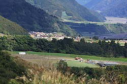 Nanshan Village in Datong Township | |
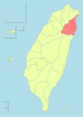
 Datong Township in Yilan County | |
| Location | Yilan County, Taiwan |
| Area | |
| • Land | 657.54 km2 (253.88 sq mi) |
| Population (September 2023) | |
| • Total | 6,042 |
| Website | www |
Datong Township (Chinese: 大同鄉; pinyin: Dàtóng Xiāng; Wade–Giles: Da4-t'ung2 Hsiang1) is a mountain indigenous township in the southwestern part of Yilan County, Taiwan. It is the second largest township in Yilan County after Nan'ao Township.
Geography


It is predominantly populated by Taiwanese aborigines of the Atayal Tribe. The township is dominated by rugged mountains and wide river valleys. Most settlements in the county are located along the Lanyang River valley which runs from the central mountains of Taiwan into the Lanyang Plain.
- Area: 657.54 km2
- Population: 6,042 people (September 2023)
Administration
The villages of Datong include Daping, Fuxing, Hanxi, Leshui, Lunpi, Mao'an, Nanshan, Siji, Songluo and Yingshi.[1] It was formerly the "Aboriginal Area" of Ratō District, Taihoku Prefecture during Japanese rule.
Economy
Economic activities include trucking silt from the Lanyang River for use in cement production and cultivation of tea, cabbage and betel nut palms.
Infrastructure
Tourist attractions

- Atayal Life Museum
- Cingshuei's Geothermal Square (清水地熱廣場)
- Hatonozawa Hot Spring (鳩之澤溫泉)
- Jiuliao River Ecological Park
- Lanyang River
- Mingchi National Forest Recreation Area
- Mount Taiping
- Qilan Forest Recreation Area
- Songluo National Trail
- Taipingshan Scenic Recreation Area
- Yulan Tea Cultivation Area
References
- ^ "County leader special area". datong.e-land.gov.tw. Archived from the original on 2008-05-13.
External links
Wikimedia Commons has media related to Datong Township, Yilan County.
Wikivoyage has a travel guide for Datong Township.
- Official website

- v
- t
- e
Cities and townships of Yilan County
- Datong
- Nan'ao
Taiwanese Indigenous Areas | ||||||||||||||||||||||||||
|---|---|---|---|---|---|---|---|---|---|---|---|---|---|---|---|---|---|---|---|---|---|---|---|---|---|---|
| Highland indigenous Townships and Districts |
| 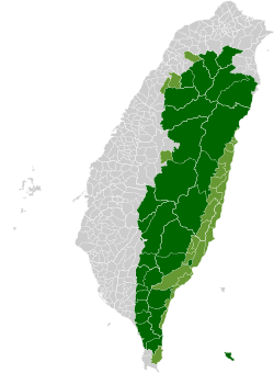 | ||||||||||||||||||||||||
| Plains indigenous Townships and County-Administered Cities |
| |||||||||||||||||||||||||
Note: On the map, "Mountain Indigenous Areas" are in dark green and "Plains Indigenous Areas" are in light green. | ||||||||||||||||||||||||||
| Authority control databases: Geographic |
|
|---|
24°40′37.8″N 121°36′32.5″E / 24.677167°N 121.609028°E / 24.677167; 121.609028
This article about a location in Taiwan is a stub. You can help Wikipedia by expanding it. |
- v
- t
- e


