Tebe-Tebe

Tebe-Tebe
Tebe-Tebe (Lesotho)
Tebe-Tebe (Lesotho)
Tebe-Tebe
Koordinaten 29° 13′ S, 27° 55′ O-29.21444427.913611Koordinaten: 29° 13′ S, 27° 55′ O
Basisdaten
Staat Lesotho
Distrikt Berea
ISO 3166-2 LS-D

Tebe-Tebe ist ein Ort und ein Community Council im Distrikt Berea im Königreich Lesotho. Im Jahre 2006 hatte der Bezirk eine Bevölkerung von 16.533 Personen.[1]

Lage

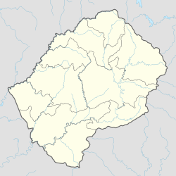
Der Ort liegt im Nordwesten des Landes.[2] Zum Council gehören die Orte[3]:

  • Ha ’Matanki
  • Ha Neko
  • Ha Boimamelo
  • Ha Jane
  • Ha Johane
  • Ha Lefoleri
  • Ha Lejone
  • Ha Lenkoane
  • Ha Leponesa
  • Ha Lereko
  • Ha Lethokonyane
  • Ha Leutsoa
  • Ha Macheche
  • Ha Majoro
  • Ha Makhatseane
  • Ha Makhula
  • Ha Malefetsane (Ha Ntlama)
  • Ha Mapeshoane (Malimong)
  • Ha Matjotjo
  • Ha Matsipe
  • Ha Mika
  • Ha Mohatlane
  • Ha Moholobela
  • Ha Mokhameleli
  • Ha Mokhethi
  • Ha Mokolanyane
  • Ha Molahli
  • Ha Mona
  • Ha Monethi
  • Ha Moorosane
  • Ha Morake
  • Ha Naleli
  • Ha Nkhahle
  • Ha Ntlama
  • Ha Ntsekhe
  • Ha Pii
  • Ha Pitso
  • Ha Ramaema
  • Ha Ramapaeane
  • Ha Ramaqele
  • Ha Ramosenyehi
  • Ha Selei
  • Ha Sello
  • Ha Tello
  • Ha Tsai
  • Ha Tsikoane
  • Ha Tsikoane Phalole
  • Ha Tsimatsi
  • Liolong
  • Lipohong
  • Litooaneng
  • Masuoeng

Einzelnachweise

  1. Lesotho Bureau of Statistics, Census Pre Results. bos.gov.ls. Archivlink
  2. Tebe-Tebe bei GeoNames, geonames.org. 1. März 2022.
  3. Lesotho Bureau of Statistics, Village List (Memento vom 13. November 2009 im Internet Archive) 2006.
Normdaten (Geografikum):